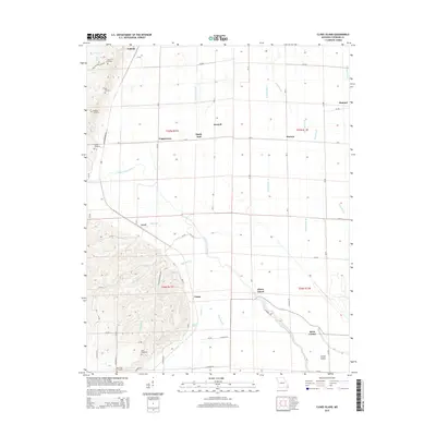
2015 Map of Clines Island
USGS Topo · Published 2015About this map
Ardeola and Himmel anchor this Stoddard County landscape, where the transition between elevated ridges and low-lying wetlands is marked by an extensive network of drainage infrastructure. This drainage system, including Ditch Number 30 and Ditch Number 33, illustrates the mid-century transformation of Missouri's bootheel into productive agricultural land. The terrain shifts from the wooded bluffs of Beech Grove Br in the southwest to the channelized plains surrounding Guam and Clines Island. Local history is deeply embedded in the numerous burial sites scattered across the hills, such as Moore Cemetery, Oak Cemetery, and Bluff Hill Cemetery. The meandering path of the Upper Castor River contrasts with the straight lines of the county roads and ditches, while Rice Lake remains a prominent feature within the protected Natl Wildlife Refuge at the northwestern edge of the sheet.
Find a feature on this map
69 named features on this map. Tap any name to fly to it.
Don’t see what you’re looking for? This feature index may not catch every label — zoom into the map to look around manually.
Map Details
Editions of this 2015 Clines Island Map
This is the sole edition of this map. No revisions or reprints were ever made.
Other maps of this area

1931 · Sikeston
USGS Topo · 1:62,500

1934 · Morley
USGS Topo · 1:62,500

1934 · Bloomfield
USGS Topo · 1:62,500

1934 · Sikeston
USGS Topo · 1:62,500

1934 · Advance
USGS Topo · 1:62,500

1939 · Bloomfield
USGS Topo · 1:62,500

1939 · Sikeston
USGS Topo · 1:62,500

1939 · Morley
USGS Topo · 1:62,500

1939 · Advance
USGS Topo · 1:62,500

1949 · Paducah
USGS Topo · 1:250,000