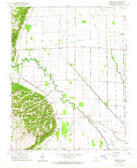
1963 Map of Clines Island
USGS Topo · Published 1964About this map
The Castor River meanders through this portion of Stoddard County, defining a landscape transition from the wooded elevations of Pike and Richland townships to the alluvial lowlands. The St Louis Southwestern Railroad cuts a straight line through the northern territory, supporting small rural hubs like Ardeola, Toppertown, and Himmel. Local history is preserved in small landmarks such as Garden Ridge Ch and the Beech Grove Sch, which once anchored these farming communities.
Find a feature on this map
33 named features on this map. Tap any name to fly to it.
Don’t see what you’re looking for? This feature index may not catch every label — zoom into the map to look around manually.
Map Details
Editions of this 1963 Clines Island Map
This is the sole edition of this map. No revisions or reprints were ever made.
Other maps of this area

1931 · Sikeston
USGS Topo · 1:62,500

1934 · Morley
USGS Topo · 1:62,500

1934 · Bloomfield
USGS Topo · 1:62,500

1934 · Sikeston
USGS Topo · 1:62,500

1934 · Advance
USGS Topo · 1:62,500

1939 · Bloomfield
USGS Topo · 1:62,500

1939 · Sikeston
USGS Topo · 1:62,500

1939 · Morley
USGS Topo · 1:62,500

1939 · Advance
USGS Topo · 1:62,500

1949 · Paducah
USGS Topo · 1:250,000