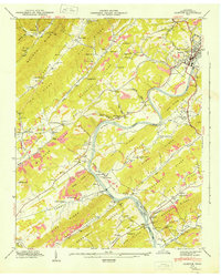
1946 Map of Clinton
USGS Topo · Published 1946About this map
The Clinton settlement serves as the focal point of this mid-century landscape, positioned where the Southern Railway meets the winding Clinch River. The geography is defined by a series of parallel ridges including Walden Ridge, Blackoak Ridge, and Chestnut Ridge, which dictate the placement of early infrastructure and small farming communities. Local industry and civic life are visible through landmarks like Spessard Mill and the County Farm, while the river's navigation is noted by mileage markers and the Edgemoor Bridge.
Find a feature on this map
85 named features on this map. Tap any name to fly to it.
Don’t see what you’re looking for? This feature index may not catch every label — zoom into the map to look around manually.
Map Details
Editions of this 1946 Clinton Map
2 editions found
Other maps of this area

1893 · Briceville
USGS Topo · 1:125,000

1895 · Loudon
USGS Topo · 1:125,000

1895 · Briceville
USGS Topo · 1:125,000

1896 · Briceville
USGS Topo · 1:125,000

1935 · Bethel Valley
USGS Topo · 1:24,000

1935 · Bearden
USGS Topo · 1:24,000

1935 · Lovell
USGS Topo · 1:24,000

1936 · Duncan Flats
USGS Topo · 1:24,000

1936 · Windrock
USGS Topo · 1:24,000

1936 · Norris Dam
USGS Topo · 1:48,000