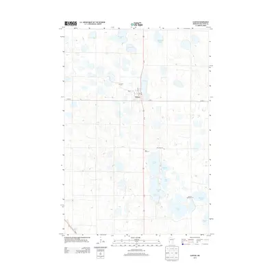
2013 Map of Clinton
USGS Topo · Published 2013About this map
Clinton serves as the central hub of this prairie landscape, where a grid of local streets like Center St and Fair St meet the corridor of Us-75. The region is defined by an intricate network of glacial lakes and wetlands, including Eli Lake and the long expanse of Lysing Lake. For local historians and genealogists, the map preserves the exact locations of several community landmarks, notably Saint Pauli Cem and Clinton Cem. The surrounding countryside is dotted with family-named water bodies such as Bentsen Lake and Thielke Lake, illustrating the settlement patterns of Big Stone County. The transition from the clustered village center to the outlying Big Stone Baptist Cem reflect the rural community's geographic spread during the early 21st century.
Find a feature on this map
24 named features on this map. Tap any name to fly to it.
Don’t see what you’re looking for? This feature index may not catch every label — zoom into the map to look around manually.
Map Details
Editions of this 2013 Clinton Map
This is the sole edition of this map. No revisions or reprints were ever made.
Other maps of this area

1916 · Beardsley
USGS Topo · 1:62,500

1918 · Beardsley
USGS Topo · 1:62,500

1950 · Graceville
USGS Topo · 1:62,500

1953 · Ortonville
USGS Topo · 1:62,500

1953 · Milbank
USGS Topo · 1:250,000

1954 · Big Stone Lake
USGS Topo · 1:62,500

1958 · Milbank
USGS Topo · 1:250,000

1971 · Big Stone Lake East
USGS Topo · 1:24,000

1971 · Dismal Swamp
USGS Topo · 1:24,000

1971 · Odessa
USGS Topo · 1:24,000