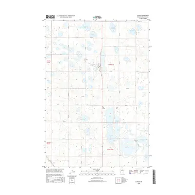
2016 Map of Clinton
USGS Topo · Published 2016About this map
The town of Clinton sits as a central hub in this Big Stone County landscape, defined by a dense concentration of glacial prairie potholes and wetlands. This 2016 survey illustrates a rural environment where land use is dictated by the water, with countless unnamed ponds surrounding larger bodies such as Thielke Lake, Elk Lake, and Swenson Lake. The transportation network follows a strict sectional grid, with U.S. Highway 75 serving as the primary north-south artery through the township lines of t123n r46w and t122n r46w. For genealogists and local historians, the map is a vital record of local interment sites, including Saint Pauli Cem, Long Island Cem, and Big Stone Baptist Cem located south of the main settlement. The abundance of sloughs, such as Sandy Slough and Bassett Slough, highlights the drainage patterns of this fertile agricultural region.
Find a feature on this map
53 named features on this map. Tap any name to fly to it.
Don’t see what you’re looking for? This feature index may not catch every label — zoom into the map to look around manually.
Map Details
Editions of this 2016 Clinton Map
This is the sole edition of this map. No revisions or reprints were ever made.
Other maps of this area

1916 · Beardsley
USGS Topo · 1:62,500

1918 · Beardsley
USGS Topo · 1:62,500

1950 · Graceville
USGS Topo · 1:62,500

1953 · Ortonville
USGS Topo · 1:62,500

1953 · Milbank
USGS Topo · 1:250,000

1954 · Big Stone Lake
USGS Topo · 1:62,500

1958 · Milbank
USGS Topo · 1:250,000

1971 · Big Stone Lake East
USGS Topo · 1:24,000

1971 · Dismal Swamp
USGS Topo · 1:24,000

1971 · Odessa
USGS Topo · 1:24,000