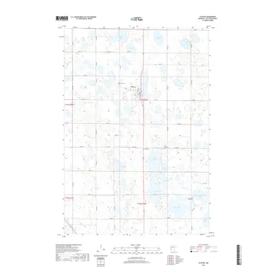
2019 Map of Clinton
USGS Topo · Published 2019About this map
Clinton serves as the central hub of this prairie landscape in Big Stone County, where the grid-like precision of agricultural land meets a complex network of glacial wetlands and lakes. The town site, clustered around Fair St and Lake St, sits just west of Eli Lake, illustrating the close relationship between early Minnesota settlements and local water sources. Genealogists can locate several historic burial grounds in the surrounding countryside, including Saint Pauli Cem to the south and Big Stone Baptist Cem to the southeast. The terrain is defined by numerous water bodies such as Swenson Lake, Thielke Lake, and South Rothwell Lake, which dominate the drainage patterns of the region. This 2019 survey documents the enduring rural structure of the area, where section roads like 330th Ave divide a landscape primarily dedicated to farming and conservation.
Find a feature on this map
35 named features on this map. Tap any name to fly to it.
Don’t see what you’re looking for? This feature index may not catch every label — zoom into the map to look around manually.
Map Details
Editions of this 2019 Clinton Map
This is the sole edition of this map. No revisions or reprints were ever made.
Other maps of this area

1916 · Beardsley
USGS Topo · 1:62,500

1918 · Beardsley
USGS Topo · 1:62,500

1950 · Graceville
USGS Topo · 1:62,500

1953 · Ortonville
USGS Topo · 1:62,500

1953 · Milbank
USGS Topo · 1:250,000

1954 · Big Stone Lake
USGS Topo · 1:62,500

1958 · Milbank
USGS Topo · 1:250,000

1971 · Big Stone Lake East
USGS Topo · 1:24,000

1971 · Dismal Swamp
USGS Topo · 1:24,000

1971 · Odessa
USGS Topo · 1:24,000