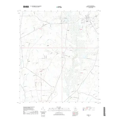
2018 Map of Clinton
USGS Topo · Published 2018About this map
Clinton stands as the primary seat of local life in East Feliciana Parish, where the grid of Jackson St and Railroad St intersects with the north-south corridor of Plank Rd. This survey highlights a landscape deeply rooted in family history and rural community, evidenced by the numerous small burial grounds scattered across the countryside. From the Masonic Cem at the town's edge to the Beutoville Cem and Rylander Cem further afield, these sites mark the legacy of the area's early inhabitants. The natural geography is defined by the winding course of the Comite River and its intricate drainage network, including Monahan Bayou and Fisher Bayou. Smaller hamlets like Battle and Grays are linked by rural roads such as Battle Rd, illustrating the persistent agricultural and residential patterns of this Louisiana parish near the turn of the 21st century.
Find a feature on this map
63 named features on this map. Tap any name to fly to it.
Don’t see what you’re looking for? This feature index may not catch every label — zoom into the map to look around manually.
Map Details
Editions of this 2018 Clinton Map
This is the sole edition of this map. No revisions or reprints were ever made.
Other maps of this area

1906 · Bayou Sara
USGS Topo · 1:125,000

1939 · Zachary
USGS Topo · 1:62,500

1941 · Woodland
USGS Topo · 1:31,680

1941 · Norwood
USGS Topo · 1:31,680

1941 · Lost Creek
USGS Topo · 1:31,680

1942 · Pride
USGS Topo · 1:31,680

1945 · Norwood
USGS Topo · 1:31,680

1945 · Jackson
USGS Topo · 1:31,680

1945 · Lost Creek
USGS Topo · 1:31,680

1946 · Clinton
USGS Topo · 1:31,680