Old Maps of East Feliciana Parish, Louisiana
Explore 120 old maps of East Feliciana Parish, spanning from 1906 to today. These high-resolution historic maps reveal how streets, neighborhoods, landmarks, and natural features evolved over time — perfect for genealogy, metal detecting, research, and local history exploration.
What you can do with these maps:
- See how East Feliciana Parish changed over time: Compare historical maps to modern-day views to trace roads, homesites, rail lines & more.
- View detailed metadata: Each map includes creators, publishers, year, scale, and archive source.
- Overlay maps with satellite & LiDAR: Visualize the past alongside modern tools to explore terrain & human change.
- Trusted historical sources: Maps sourced from the USGS, Library of Congress, and other archives.
- Access maps your way: View online, download high-res files, or order prints for personal or research use.
Start exploring old maps of East Feliciana Parish to uncover forgotten places, hidden landmarks, and the deep history beneath your feet.
East Feliciana Parish, LA maps
(120)- 1906 Map of Bayou Sara
 1906 Bayou Sara1906 Print · USGSThe Feliciana parishes and the Mississippi River bottomlands come to life in this early twentieth-century survey. Genealogists can trace family footprints through river-town settlements like St Francisville or find early rail stops such as Gayden Sta (Gurley P.O.) and Slaughter.3 unique versions available
 - 1939 Map of St. Francisville
 1939 St. Francisville1939 Print · USGSWest Feliciana Parish and the Mississippi River borderlands are captured here in the late 1930s. Genealogists and historians can trace the foundations of the plantation economy through landmarks like Magnolia Plantation and schools like Afton Villa Ch & Sch.3 unique versions available
 - 1939 Map of Zachary, 1941 Print
 1939 Zachary1941 Print · USGSEast Baton Rouge and East Feliciana parishes are documented here in the late 1930s, showing the vital rail-and-river economy before modern suburbanization. Genealogists can trace early landmarks like Leland College, Goodhope Ch, and the many cemeteries along White Bayou.2 unique versions available
 - 1941 Map of Woodland
 1941 Woodland1941 Print · USGSEast Feliciana Parish and the Mississippi borderlands are captured here in the early 1940s. Researchers can trace rural life through landmarks like Felixville P. O., family sites like Kent Cem, and schools such as Phares Sch and Macedonia Sch.
 - 1941 Map of Norwood
 1941 Norwood1941 Print · USGSEast Feliciana Parish near the Mississippi border reveals its 1940s landscape of rural settlements and transport corridors. Genealogists can trace family roots through landmarks like Antioch Ch, Morning Glory Ch, and burial sites such as Beech Grove Cem.
 - 1941 Map of Gilead
 1941 Gilead1941 Print · USGSSt. Helena and East Feliciana parishes are documented here in the early 1940s, split by the winding Amite River. Genealogists can trace family roots at Powers Cem and Youngblood Cem or locate local hubs like Wesley Chapel and Gilead.
 - 1941 Map of Lost Creek
 1941 Lost Creek1941 Print · USGSThe borderlands of East and West Feliciana Parish come alive in this early 1940s survey of rural Louisiana. Genealogists can trace family landmarks like Rogillioville, Hickory Grove Sch, and the Mc Queen Cem alongside the Illinois Central rail line.
 - 1941 Map of Chipola
 1941 Chipola1941 Print · USGSSt. Helena and East Feliciana parishes are shown here in the early 1940s just as the modern highway system began to solidify. Family historians can trace local roots at Hurst Cem, Joiners, and rural school sites like St Helena Sch.
 - 1942 Map of Pine Grove
 1942 Pine Grove1942 Print · USGSSt. Helena Parish and the surrounding borderlands are captured here in the early 1940s as the regional logging rail era gives way to a modern highway network. Researchers can trace family sites at Sand Hill Cem and Salem Ch, or locate vanished local landmarks like Story Sch and the Old Grade.
 - 1942 Map of Pride
 1942 Pride1942 Print · USGSEast Baton Rouge and surrounding parishes are shown here in the early 1940s, a landscape defined by the Amite River and rural crossroads. You can trace community roots through many local landmarks, including Dennis Mills, Harrell Sch, and Stony Point Cem.
 - 1942 Map of Gilead
 1942 Gilead1942 Print · USGSSt. Helena and East Feliciana Parishes are captured here in the early 1940s, split by the meandering Amite River. Researchers can trace the footprints of rural life through old landmarks like Sunflower Sch, Pipkin Chapel, and Powers Cem.
 - 1945 Map of Norwood
 1945 Norwood1945 Print · USGSEast Feliciana Parish near the Mississippi border is shown here during the mid-1940s, centered on the Illinois Central rail line. Researchers can trace rural genealogy through landmarks like Pemble Cem, Morning Glory Ch, and the Industrial Training Sch.
 - 1945 Map of Jackson
 1945 Jackson1945 Print · USGSEast Feliciana Parish in the mid-1940s is shown here as a landscape of rural schoolhouses, family cemeteries, and institutional colonies. Researchers can trace the Illinois Central railroad and locate sites like Keller School, Evergreen Cemetery, and the Jackson town site.
 - 1945 Map of Chipola
 1945 Chipola1945 Print · USGSSt. Helena Parish was a landscape of small crossroads and creek-side settlements in the years following the Great Depression. Genealogists and local historians can trace family locations near Chipola, Darlington, and rural landmarks like the Riverside Sch.
 - 1945 Map of Lost Creek
 1945 Lost Creek1945 Print · USGSThe rural border of East and West Feliciana Parishes comes into focus in the mid-1940s, revealing a dense network of country schools and family cemeteries. Genealogists can trace the exact locations of Rogillio-ville, the Mc Queen Cem, and Hickory Grove Sch.
 - 1946 Map of Clinton
 1946 Clinton1946 Print · USGSEast Feliciana Parish at the end of the Second World War was a landscape of small rural schools and family cemeteries. Researchers can trace land ties and lineage through sites like Ross and Dilly Sch, Clinton, and the Illinois Central rail line.
 - 1949 Map of Bluff Creek
 1949 Bluff Creek1949 Print · USGSEast Feliciana Parish was characterized by a dense network of bayous and small family-run farms in the years following the war. Genealogists and historians can trace local families through many rural burial grounds like Booker Cem and Irwin Cem or locate the site of the Prencent Sch.
 - 1954 Map of Pride, 1955 Print
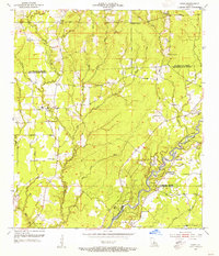 1954 Pride1955 Print · USGSEast Baton Rouge and surrounding parishes are captured here in the mid-1950s, a landscape defined by the winding Amite River and numerous bayous. Researchers can trace rural lineages through sites like Oaknolia, South Union Ch, and the Stony Point Cem.2 unique versions available
 - 1954 Map of Zachary, 1955 Print
 1954 Zachary1955 Print · USGSThe parishes of East Feliciana and East Baton Rouge are captured here in the mid-fifties, centered on the growing rail corridor between Zachary and Slaughter. Local historians can trace family-named sites like McHugh Cem, Shaffer Cem, and the McKowen Sch.
 - 1954 Map of Port Hudson, 1955 Print
 1954 Port Hudson1955 Print · USGSMid-century life along the Mississippi is captured here at the intersection of five Louisiana parishes. Genealogists and local researchers can trace family landmarks like Hermitage P.O., Beech Grove Ch No 2 Cem, and the historic Port Hudson riverfront.
 - 1954 Map of Clinton, 1955 Print
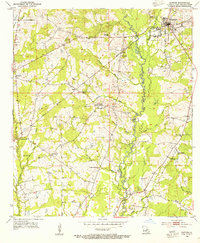 1954 Clinton1955 Print · USGSEast Feliciana Parish in the mid-fifties is captured here as a landscape of rural community hubs and river-bottom drainage. Genealogists can trace family names across numerous landmarks, including Knighton Bayou Ch, Spears Sch, and the Masonic Cem.4 unique versions available
 - 1954 Map of Elm Park, 1955 Print
 1954 Elm Park1955 Print · USGSWest Feliciana Parish in the mid-fifties remains a landscape of deep creek valleys and historic estates like Troy Plantation and Cottage Plantation. Genealogists and local historians can trace family locations through Starhill Cem and rural nodes like Beechwood or the Rosendwald Sch.
 - 1954 Map of Fred, 1955 Print
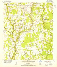 1954 Fred1955 Print · USGSEast Baton Rouge and East Feliciana Parishes are shown in the mid-fifties, dominated by the winding course of the Comite River. Researchers can trace rural life through numerous landmarks like the Eastern Star Sch, Deerford settlement, and Mose Chapel.
 - 1954 Map of Jackson, 1955 Print
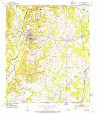 1954 Jackson1955 Print · USGSJackson and the surrounding Feliciana parishes are captured in the mid-1950s, a period defined by large institutional grounds and rural rail junctions. Genealogists can trace family names at Green Briar Cem or locate the various East Louisiana State Hospital colonies and the Illinois Central line.4 unique versions available
 - 1954 Map of Baton Rouge, 1974 Print
 1954 Baton Rouge1974 Print · USGSSoutheast Louisiana in the mid-fifties is captured here during a period of transition for its river and rail economies. Researchers can trace the path of the Mississippi River and find landmarks like the Bonnet Carre Spillway and Bayou Plaquemine.2 unique versions available
Showing maps 1-25 of 120
Top cities of East Feliciana Parish
- Jackson historical maps
- Clinton historical maps
- Slaughter historical maps
- Wilson historical maps
- Norwood historical maps
Frequently asked questions
- What are the different types of historical maps available for East Feliciana Parish?
- What is the oldest map of East Feliciana Parish?
- Where can I purchase historical maps of East Feliciana Parish for my home or office?
- Where can I download high-res historical maps of East Feliciana Parish?
- Are there historical topographic maps available for East Feliciana Parish?
- Is there historical aerial imagery available for East Feliciana Parish?
- Where are historical maps of East Feliciana Parish sourced from?