Old Maps of East Feliciana Parish, Louisiana for Hiking & Exploration
Hike through history with 64 historic maps of East Feliciana Parish. Explore old trails, ghost towns, and forgotten backroads — perfect for outdoor adventurers and local explorers.
- Rediscover forgotten places: Map out old mining camps, roads, and footpaths that no longer exist on modern maps.
- Layer with modern tools: Combine with LiDAR or satellite views to plan hikes through historical terrain.
- Made for exploration: Popular among hikers, overlanders, and local history lovers.
Use these maps to find adventure and explore the hidden past of East Feliciana Parish.
East Feliciana Parish, LA maps
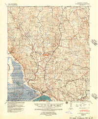
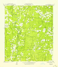
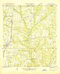
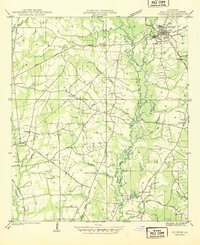
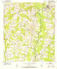
(64)- 1906 Map of Bayou Sara
 1906 Bayou Sara1906 Print · USGSCovers East Feliciana Parish, including Baton Rouge, Central, and other nearby areas3 unique versions available
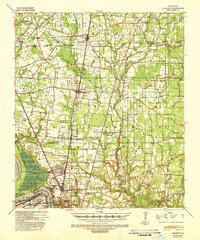
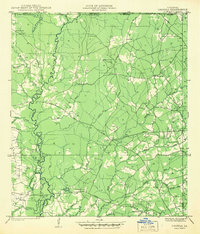
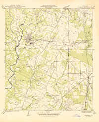
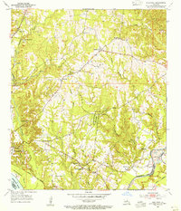
 - 1939 Map of St. Francisville
 1939 St. Francisville1939 Print · USGSCovers East Feliciana Parish, including Saint Francisville, St. Francisville, and other nearby areas3 unique versions available
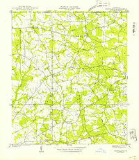
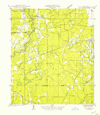
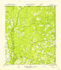
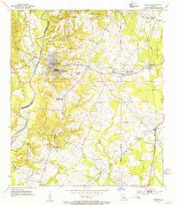
 - 1939 Map of Zachary, 1941 Print
 1939 Zachary1941 Print · USGSCovers East Feliciana Parish, including Baton Rouge, Central, and other nearby areas2 unique versions available
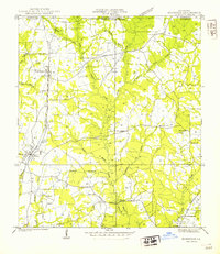
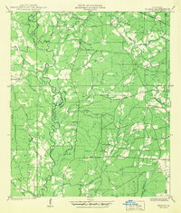
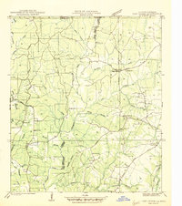
 - 1941 Map of Woodland
 1941 Woodland1941 Print · USGSCovers East Feliciana Parish, including Teddy, Felixville, and other nearby areas
 - 1941 Map of Norwood
 1941 Norwood1941 Print · USGSCovers East Feliciana Parish, including Clinton, Wilson, and other nearby areas
 - 1941 Map of Gilead
 1941 Gilead1941 Print · USGSCovers East Feliciana Parish, including Hatchersville, Gilead, and other nearby areas
 - 1941 Map of Lost Creek
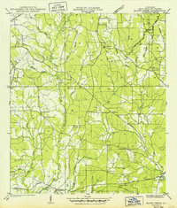
 1941 Lost Creek1941 Print · USGSCovers East Feliciana Parish, including Wilson, Norwood, and other nearby areas
 - 1941 Map of Chipola
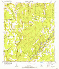
 1941 Chipola1941 Print · USGSCovers East Feliciana Parish, including Darlington, Chipola, and other nearby areas
 - 1942 Map of Pine Grove
 1942 Pine Grove1942 Print · USGSCovers East Feliciana Parish, including Oldfield, Grangeville, and other nearby areas
 - 1942 Map of Pride
 1942 Pride1942 Print · USGSCovers East Feliciana Parish, including Oaknolia, Reiley, and other nearby areas
 - 1942 Map of Gilead
 1942 Gilead1942 Print · USGSCovers East Feliciana Parish, including Hatchersville, Gilead, and other nearby areas
 - 1945 Map of Norwood
 1945 Norwood1945 Print · USGSCovers East Feliciana Parish, including Clinton, Wilson, and other nearby areas
 - 1945 Map of Jackson
 1945 Jackson1945 Print · USGSCovers East Feliciana Parish, including Jackson, Cole, and other nearby areas
 - 1945 Map of Chipola
 1945 Chipola1945 Print · USGSCovers East Feliciana Parish, including Darlington, Chipola, and other nearby areas
 - 1945 Map of Lost Creek
 1945 Lost Creek1945 Print · USGSCovers East Feliciana Parish, including Wilson, Norwood, and other nearby areas
 - 1946 Map of Clinton
 1946 Clinton1946 Print · USGSCovers East Feliciana Parish, including Clinton, Browns, and other nearby areas
 - 1949 Map of Bluff Creek
 1949 Bluff Creek1949 Print · USGSCovers East Feliciana Parish, including Blairstown, United States, and other nearby areas
 - 1954 Map of Pride, 1955 Print
 1954 Pride1955 Print · USGSCovers East Feliciana Parish, including Oaknolia, Reiley, and other nearby areas2 unique versions available
 - 1954 Map of Zachary, 1955 Print
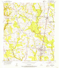 1954 Zachary1955 Print · USGSCovers East Feliciana Parish, including Zachary, Slaughter, and other nearby areas
 - 1954 Map of Port Hudson, 1955 Print
 1954 Port Hudson1955 Print · USGSCovers East Feliciana Parish, including Waterloo, Riddle, and other nearby areas
 - 1954 Map of Clinton, 1955 Print
 1954 Clinton1955 Print · USGSCovers East Feliciana Parish, including Clinton, Browns, and other nearby areas4 unique versions available
 - 1954 Map of Elm Park, 1955 Print
 1954 Elm Park1955 Print · USGSCovers East Feliciana Parish, including St. Francisville, Freeland, and other nearby areas
 - 1954 Map of Fred, 1955 Print
 1954 Fred1955 Print · USGSCovers East Feliciana Parish, including Central, Zachary, and other nearby areas
 - 1954 Map of Jackson, 1955 Print
 1954 Jackson1955 Print · USGSCovers East Feliciana Parish, including Jackson, Cole, and other nearby areas4 unique versions available
 - 1954 Map of Baton Rouge, 1974 Print
 1954 Baton Rouge1974 Print · USGSCovers East Feliciana Parish, including New Orleans, Baton Rouge, and other nearby areas2 unique versions available
Showing maps 1-25 of 64
Top cities of East Feliciana Parish
- Jackson historical maps
- Clinton historical maps
- Slaughter historical maps
- Wilson historical maps
- Norwood historical maps
Frequently asked questions
- What are the different types of historical maps available for East Feliciana Parish?
- What is the oldest map of East Feliciana Parish?
- Where can I purchase historical maps of East Feliciana Parish for my home or office?
- Where can I download high-res historical maps of East Feliciana Parish?
- Are there historical topographic maps available for East Feliciana Parish?
- Is there historical aerial imagery available for East Feliciana Parish?
- Where are historical maps of East Feliciana Parish sourced from?