Old Maps of East Feliciana Parish, Louisiana for Genealogy
Trace your family roots with 64 historic maps of East Feliciana Parish. These high-res maps reveal old neighborhoods, homesites, landmarks, and streets — helping you uncover where your ancestors lived and how the area evolved over time.
- Explore historic neighborhoods: Identify where your relatives may have lived in the 1800s or 1900s.
- Compare maps over time: Trace the changes in streets, buildings, and landmarks for multi-generational research.
- Perfect for genealogy & ancestry research: Used by family historians and researchers to map out lineage and migration.
These maps are an incredible resource for exploring your personal connection to East Feliciana Parish's past.
East Feliciana Parish, LA maps
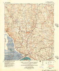
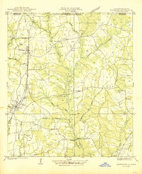
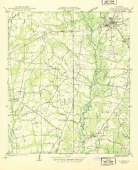
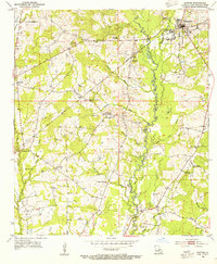
(64)- 1906 Map of Bayou Sara
 1906 Bayou Sara1906 Print · USGSCovers East Feliciana Parish, including Baton Rouge, Central, and other nearby areas3 unique versions available
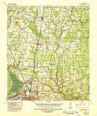
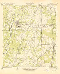
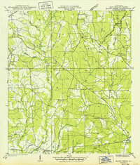
 - 1939 Map of St. Francisville
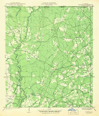
 1939 St. Francisville1939 Print · USGSCovers East Feliciana Parish, including Saint Francisville, St. Francisville, and other nearby areas3 unique versions available
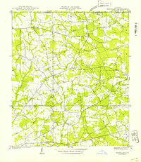
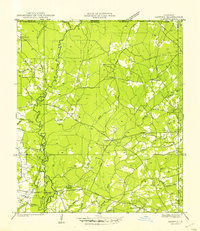
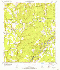
 - 1939 Map of Zachary, 1941 Print
 1939 Zachary1941 Print · USGSCovers East Feliciana Parish, including Baton Rouge, Central, and other nearby areas2 unique versions available
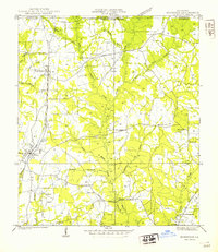
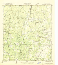
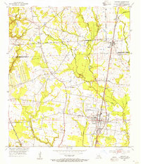
 - 1941 Map of Woodland
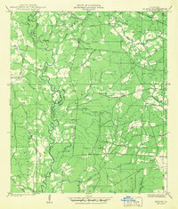
 1941 Woodland1941 Print · USGSCovers East Feliciana Parish, including Teddy, Felixville, and other nearby areas
 - 1941 Map of Norwood
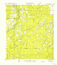
 1941 Norwood1941 Print · USGSCovers East Feliciana Parish, including Clinton, Wilson, and other nearby areas
 - 1941 Map of Gilead
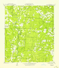 1941 Gilead1941 Print · USGSCovers East Feliciana Parish, including Hatchersville, Gilead, and other nearby areas
 - 1941 Map of Lost Creek
 1941 Lost Creek1941 Print · USGSCovers East Feliciana Parish, including Wilson, Norwood, and other nearby areas
 - 1941 Map of Chipola
 1941 Chipola1941 Print · USGSCovers East Feliciana Parish, including Darlington, Chipola, and other nearby areas
 - 1942 Map of Pine Grove
 1942 Pine Grove1942 Print · USGSCovers East Feliciana Parish, including Oldfield, Grangeville, and other nearby areas
 - 1942 Map of Pride
 1942 Pride1942 Print · USGSCovers East Feliciana Parish, including Oaknolia, Reiley, and other nearby areas
 - 1942 Map of Gilead
 1942 Gilead1942 Print · USGSCovers East Feliciana Parish, including Hatchersville, Gilead, and other nearby areas
 - 1945 Map of Norwood
 1945 Norwood1945 Print · USGSCovers East Feliciana Parish, including Clinton, Wilson, and other nearby areas
 - 1945 Map of Jackson
 1945 Jackson1945 Print · USGSCovers East Feliciana Parish, including Jackson, Cole, and other nearby areas
 - 1945 Map of Chipola
 1945 Chipola1945 Print · USGSCovers East Feliciana Parish, including Darlington, Chipola, and other nearby areas
 - 1945 Map of Lost Creek
 1945 Lost Creek1945 Print · USGSCovers East Feliciana Parish, including Wilson, Norwood, and other nearby areas
 - 1946 Map of Clinton
 1946 Clinton1946 Print · USGSCovers East Feliciana Parish, including Clinton, Browns, and other nearby areas
 - 1949 Map of Bluff Creek
 1949 Bluff Creek1949 Print · USGSCovers East Feliciana Parish, including Blairstown, United States, and other nearby areas
 - 1954 Map of Pride, 1955 Print
 1954 Pride1955 Print · USGSCovers East Feliciana Parish, including Oaknolia, Reiley, and other nearby areas2 unique versions available
 - 1954 Map of Zachary, 1955 Print
 1954 Zachary1955 Print · USGSCovers East Feliciana Parish, including Zachary, Slaughter, and other nearby areas
 - 1954 Map of Port Hudson, 1955 Print
 1954 Port Hudson1955 Print · USGSCovers East Feliciana Parish, including Waterloo, Riddle, and other nearby areas
 - 1954 Map of Clinton, 1955 Print
 1954 Clinton1955 Print · USGSCovers East Feliciana Parish, including Clinton, Browns, and other nearby areas4 unique versions available
 - 1954 Map of Elm Park, 1955 Print
 1954 Elm Park1955 Print · USGSCovers East Feliciana Parish, including St. Francisville, Freeland, and other nearby areas
 - 1954 Map of Fred, 1955 Print
 1954 Fred1955 Print · USGSCovers East Feliciana Parish, including Central, Zachary, and other nearby areas
 - 1954 Map of Jackson, 1955 Print
 1954 Jackson1955 Print · USGSCovers East Feliciana Parish, including Jackson, Cole, and other nearby areas4 unique versions available
 - 1954 Map of Baton Rouge, 1974 Print
 1954 Baton Rouge1974 Print · USGSCovers East Feliciana Parish, including New Orleans, Baton Rouge, and other nearby areas2 unique versions available
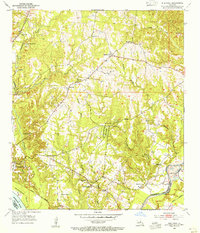
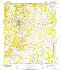
Showing maps 1-25 of 64
Top cities of East Feliciana Parish
- Jackson historical maps
- Clinton historical maps
- Slaughter historical maps
- Wilson historical maps
- Norwood historical maps
Frequently asked questions
- What are the different types of historical maps available for East Feliciana Parish?
- What is the oldest map of East Feliciana Parish?
- Where can I purchase historical maps of East Feliciana Parish for my home or office?
- Where can I download high-res historical maps of East Feliciana Parish?
- Are there historical topographic maps available for East Feliciana Parish?
- Is there historical aerial imagery available for East Feliciana Parish?
- Where are historical maps of East Feliciana Parish sourced from?