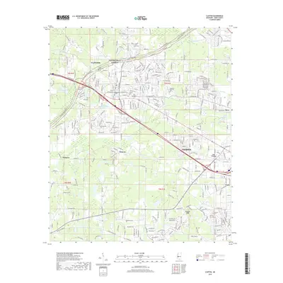
2018 Map of Clinton
USGS Topo · Published 2018About this map
Clinton and the western edge of Jackson dominate this 2018 topographic survey, capturing a landscape defined by collegiate history and transportation corridors. The historic Mississippi College campus sits at the heart of the community, surrounded by several important local burial grounds including the Cowles Meade Cem, Clinton Cem, and Odd Fellows Cem. The presence of the Kansas City Southern railroad and the Natchez Trace Pkwy illustrates the town's enduring role as a transit hub between the state capital and the rural interior. In the outlying areas, smaller settlements such as McRaven, Van Winkle, and Forest Hill indicate the suburban development pattern typical of the Hinds County region. Water features like Mississippi College Lake, Bakers Cr, and Lynch Cr drain the varied terrain, while Lakewood Memorial Park provides significant open space near the Jackson city line.
Find a feature on this map
286 named features on this map. Tap any name to fly to it.
Don’t see what you’re looking for? This feature index may not catch every label — zoom into the map to look around manually.
Map Details
Editions of this 2018 Clinton Map
This is the sole edition of this map. No revisions or reprints were ever made.
Other maps of this area

1903 · Jackson
USGS Topo · 1:125,000

1905 · Jackson
USGS Topo · 1:48,000

1906 · Florence
USGS Topo · 1:62,500

1908 · Jackson
USGS Topo · 1:62,500

1908 · Florence
USGS Topo · 1:62,500

1934 · Raymond
USGS Topo · 1:48,000

1937 · Raymond
USGS Topo · 1:62,500

1937 · Terry
USGS Topo · 1:48,000

1942 · Raymond
USGS Topo · 1:62,500

1943 · Terry
USGS Topo · 1:62,500