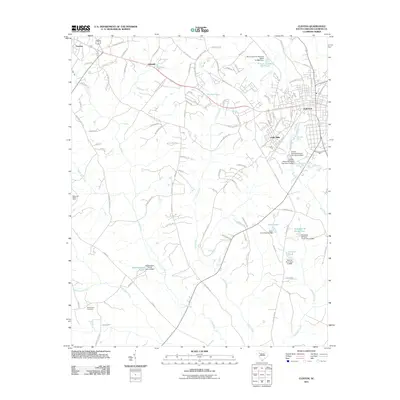
2011 Map of Clinton
USGS Topo · Published 2011About this map
The textile heritage and rural landscape of Laurens County define this 2011 survey, centered on the industrial and residential corridors of Clinton. Significant industrial water features like the Clinton Cotton Mill Pond and Lydia Mills point to the area's long-standing manufacturing history, while newer residential developments like Lakeside and Dogwood Ridge Farm show the evolving footprint of the region. The landscape is deeply etched by water, with the Bush River and Little River draining the Piedmont terrain into a series of smaller, family-named impoundments such as Elizabeth M Davis Pond and Cannon Pond. Genealogy and local history researchers can locate the Beaverdam Cemetery in the southwest, while the northern extent shows the expansion of the town toward Laurens via local routes like State Hwy S-30-741.
Find a feature on this map
108 named features on this map. Tap any name to fly to it.
Don’t see what you’re looking for? This feature index may not catch every label — zoom into the map to look around manually.
Map Details
Editions of this 2011 Clinton Map
This is the sole edition of this map. No revisions or reprints were ever made.
Other maps of this area

1892 · Abbeville
USGS Topo · 1:125,000

1941 · Spartanburg
USGS Topo · 1:250,000

1953 · Spartanburg
USGS Topo · 1:250,000

1954 · Greenville
USGS Topo · 1:250,000

1957 · Fountain Inn
USGS Topo · 1:62,500

1958 · Greenville
USGS Topo · 1:250,000

1960 · Spartanburg
USGS Topo · 1:250,000

1963 · Spartanburg
USGS Topo · 1:250,000

1964 · Spartanburg
USGS Topo · 1:250,000

1969 · Ora
USGS Topo · 1:24,000