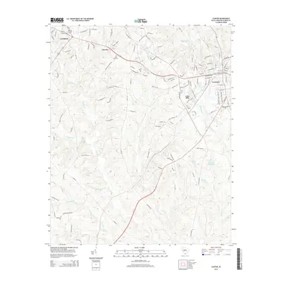
2014 Map of Clinton
USGS Topo · Published 2014About this map
Clinton and Laurens anchor this section of the South Carolina Upstate, showing the continued development of these Piedmont textile and agricultural hubs. The presence of Lydia Mills and the Clinton Cotton Mill Pond highlights the industrial legacy of the area, where water power and rail once drove local growth. Between these urban centers, the landscape is defined by a dense network of country roads such as Beaverdam Church Rd and Holly Grove Church Rd, connecting rural settlements and family landmarks. Genealogists will find interest in sites like Holy Grove Cem and Beaverdam Cem. The terrain is drained by the Bush River and Little River, which are punctuated by numerous private water bodies like Elizabeth M Davis Pond and Blackmonds Pond, reflecting the region's managed water resources for recreation and industry.
Find a feature on this map
124 named features on this map. Tap any name to fly to it.
Don’t see what you’re looking for? This feature index may not catch every label — zoom into the map to look around manually.
Map Details
Editions of this 2014 Clinton Map
This is the sole edition of this map. No revisions or reprints were ever made.
Other maps of this area

1892 · Abbeville
USGS Topo · 1:125,000

1941 · Spartanburg
USGS Topo · 1:250,000

1953 · Spartanburg
USGS Topo · 1:250,000

1954 · Greenville
USGS Topo · 1:250,000

1957 · Fountain Inn
USGS Topo · 1:62,500

1958 · Greenville
USGS Topo · 1:250,000

1960 · Spartanburg
USGS Topo · 1:250,000

1963 · Spartanburg
USGS Topo · 1:250,000

1964 · Spartanburg
USGS Topo · 1:250,000

1969 · Ora
USGS Topo · 1:24,000