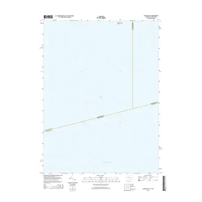
2015 Map of Clinton OE S
USGS Topo · Published 2015About this map
Long Island Sound dominates this maritime survey, documenting the jurisdictional waters between Connecticut and New York. The map focuses on the open sea, marked only by the Intracoastal Waterway and the prominent landmark of Hammonasset Point at the northern edge. This chart illustrates the complex aquatic borders where New Haven, Middlesex, and Suffolk counties meet. It serves as a clear record of the nautical boundaries and navigation paths used by regional mariners and researchers tracking coastal geography in the mid-2010s.
Find a feature on this map
7 named features on this map. Tap any name to fly to it.
Don’t see what you’re looking for? This feature index may not catch every label — zoom into the map to look around manually.
Map Details
Editions of this 2015 Clinton OE S Map
This is the sole edition of this map. No revisions or reprints were ever made.
Other maps of this area

1893 · Guilford
USGS Topo · 1:62,500

1893 · Saybrook
USGS Topo · 1:62,500

1904 · Shelter Island
USGS Topo · 1:62,500

1944 · Essex
USGS Topo · 1:31,680

1947 · Mattituck Hills
USGS Topo · 1:24,000

1947 · Southold
USGS Topo · 1:24,000

1947 · Hartford
USGS Topo · 1:250,000

1948 · Hartford
USGS Topo · 1:250,000

1951 · Clinton
USGS Topo · 1:31,680

1954 · Guilford
USGS Topo · 1:31,680
Featured Places
- Southold, NY
- Madison, CT
- Clinton, CT
- Suffolk County, NY
- Lower Connecticut River Valley Planning Region, CT