
2024 Map of Clinton OE S
USGS Topo · Published 2024About this map
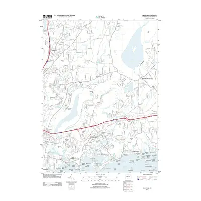
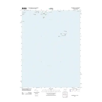
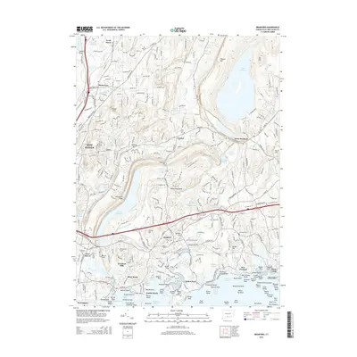
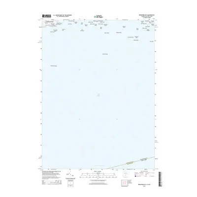
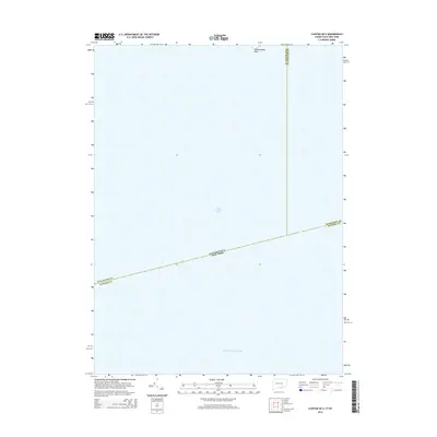
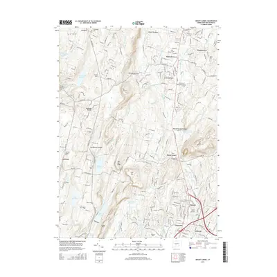
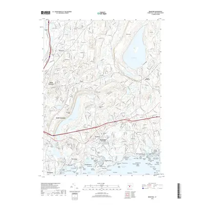
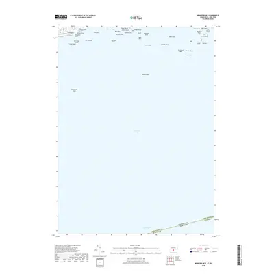
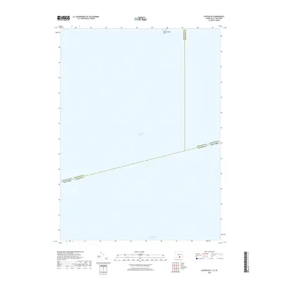
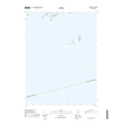
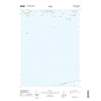
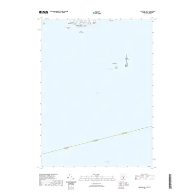
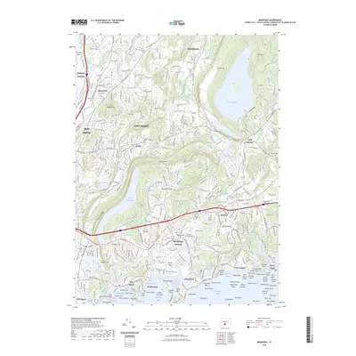
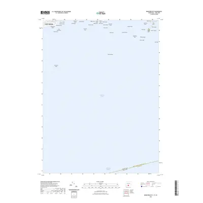
Long Island Sound dominates this maritime expanse, where the coastal waters meet the administrative boundaries of New York and Connecticut. The map centers on the open waters south of Hammonasset Point, a distinct landform marking the northern shoreline. Tracing the maritime routes, the Intracoastal Waterway runs along the southern edge of the quadrangle, highlighting the navigational significance of the sound. This area serves as a jurisdictional crossroads, where the South Central Connecticut Planning Region and the Lower Connecticut River Valley Planning Region meet the northern limits of Suffolk Co at the state line. The map illustrates the specialized maritime geography and regional planning boundaries of the early 2020s.
Find a feature on this map
7 named features on this map. Tap any name to fly to it.
Don’t see what you’re looking for? This feature index may not catch every label — zoom into the map to look around manually.
Map Details
Editions of this 2024 Clinton OE S Map
This is the sole edition of this map. No revisions or reprints were ever made.
Historical Maps of Southold Through Time
67 maps found

1946 Southington
New Haven County, CT

1951 Milford
New Haven County, CT

1953 Southbury
New Haven County, CT

1954 Guilford
New Haven County, CT

1954 Mount Carmel
New Haven County, CT

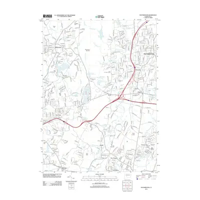
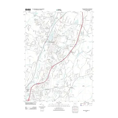
1954 Wallingford
New Haven County, CT

1955 Southington
New Haven County, CT

1960 Milford
New Haven County, CT

1964 Southbury
New Haven County, CT

1967 Mount Carmel
New Haven County, CT

1967 Wallingford
New Haven County, CT

1968 Guilford
New Haven County, CT

1968 Southington
New Haven County, CT

1984 Milford
New Haven County, CT
2012 Branford
New Haven County, CT
2012 Branford OE S
New Haven County, CT
2012 Clinton OE S
New Haven County, CT
2012 Guilford
New Haven County, CT
2012 Guilford OE S
New Haven County, CT
2012 Milford
New Haven County, CT
2012 Mount Carmel
New Haven County, CT
2012 Southbury
New Haven County, CT
2012 Southington
New Haven County, CT
2012 Wallingford
New Haven County, CT
2015 Branford
New Haven County, CT
2015 Branford OE S
New Haven County, CT
2015 Clinton OE S
New Haven County, CT
2015 Guilford
New Haven County, CT
2015 Guilford OE S
New Haven County, CT
2015 Milford
New Haven County, CT
2015 Mount Carmel
New Haven County, CT
2015 Southbury
New Haven County, CT
2015 Southington
New Haven County, CT
2015 Wallingford
New Haven County, CT
2018 Branford
New Haven County, CT
2018 Branford OE S
New Haven County, CT
2018 Clinton OE S
New Haven County, CT
2018 Guilford
New Haven County, CT
2018 Guilford OE S
New Haven County, CT
2018 Milford
New Haven County, CT
2018 Mount Carmel
New Haven County, CT
2018 Southbury
New Haven County, CT
2018 Southington
New Haven County, CT
2018 Wallingford
New Haven County, CT
2021 Branford
New Haven County, CT
2021 Branford OE S
New Haven County, CT

2021 Clinton OE S
New Haven County, CT
2021 Guilford
New Haven County, CT
2021 Guilford OE S
New Haven County, CT
2021 Milford
New Haven County, CT
2021 Mount Carmel
New Haven County, CT
2021 Southbury
New Haven County, CT
2021 Southington
New Haven County, CT
2021 Wallingford
New Haven County, CT
2023 Branford
New Haven County, CT
2023 Branford OE S
New Haven County, CT
2023 Guilford
New Haven County, CT

2024 Branford
New Haven County, CT

2024 Branford OE S
New Haven County, CT
2024 Clinton OE S
New Haven County, CT

2024 Guilford
New Haven County, CT

2024 Guilford OE S
New Haven County, CT

2024 Milford
New Haven County, CT

2024 Mount Carmel
New Haven County, CT

2024 Southbury
New Haven County, CT

2024 Southington
New Haven County, CT

2024 Wallingford
New Haven County, CT
Featured Locations
- Lower Connecticut River Valley Planning Region, CT
- Suffolk County, NY
- Southold, NY
- Madison, CT
- Clinton, CT