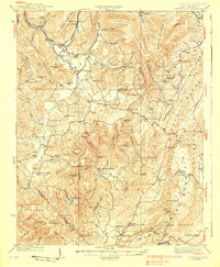
1939 Map of Clintonville
USGS Topo · Published 1939About this map
Blue Sulphur Springs and the rural communities of Greenbrier County define this 1939 survey, which documents the region's transition as mountain farming and early transportation networks matured. The landscape is a dense network of one-room schoolhouses and country churches, such as Sawmill Hollow School, Meadow Mountain School, and the Woods Memorial Church. These institutions served dispersed settlements like Meadow Bluff and Asbury, reflecting a localized social structure before modern consolidation.
Find a feature on this map
103 named features on this map. Tap any name to fly to it.
Don’t see what you’re looking for? This feature index may not catch every label — zoom into the map to look around manually.
Map Details
Editions of this 1939 Clintonville Map
2 editions found
Other maps of this area

1887 · Hinton
USGS Topo · 1:125,000

1887 · Lewisburg
USGS Topo · 1:125,000

1889 · Nicholas
USGS Topo · 1:125,000

1891 · Lewisburg
USGS Topo · 1:125,000

1891 · Nicholas
USGS Topo · 1:125,000

1891 · Huntersville
USGS Topo · 1:125,000

1892 · Hinton
USGS Topo · 1:125,000

1894 · Huntersville
USGS Topo · 1:125,000

1901 · Nicholas
USGS Topo · 1:125,000

1912 · Meadow Creek
USGS Topo · 1:48,000