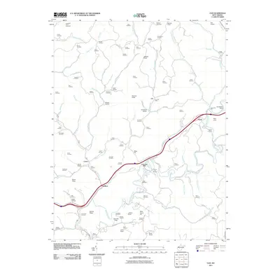
2011 Map of Clio
USGS Topo · Published 2011About this map
Osbornes Mills and Amma anchor this West Virginia landscape, where the winding course of Big Sandy Creek and Hurricane Creek dictated the placement of small communities and family farmsteads. The terrain is characterized by a dense network of ridges and hollows, such as Board Ridge and Cobb Hollow, interspersed with named peaks like Kate Knob and Lizann Knob. For genealogists, the map is remarkably dense with family-named landmarks, documenting dozens of burial grounds including the Rolling Hill Cemetery, Hively Cemetery, and Shamlin Cemetery. The transition between the small settlements of Clio and Wellford is marked by prominent geological features like Starcher Rocks and Jackson Rocks. The presence of the Clio Post Office and Amma Post Office highlights the continuing role of these rural centers, while Camp Whitney suggests the area's development for recreation alongside its long-standing agricultural and residential foundations.
Find a feature on this map
123 named features on this map. Tap any name to fly to it.
Don’t see what you’re looking for? This feature index may not catch every label — zoom into the map to look around manually.
Map Details
Editions of this 2011 Clio Map
This is the sole edition of this map. No revisions or reprints were ever made.
Other maps of this area

1897 · Kanawha Falls
USGS Topo · 1:125,000

1900 · Kanawha Falls
USGS Topo · 1:125,000

1901 · Kanawha Falls
USGS Topo · 1:125,000

1906 · Otter
USGS Topo · 1:62,500

1906 · Walton
USGS Topo · 1:62,500

1907 · Otter
USGS Topo · 1:62,500

1907 · Walton
USGS Topo · 1:62,500

1907 · Clendenin
USGS Topo · 1:62,500

1908 · Clay
USGS Topo · 1:48,000

1909 · Clendenin
USGS Topo · 1:62,500