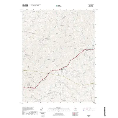
2019 Map of Clio
USGS Topo · Published 2019About this map
Osbornes Mills and Wellford anchor the southern reaches of this Appalachian landscape, where the winding course of Big Sandy Creek dictates the placement of settlements and roads. The terrain is characterized by a dense network of ridges and hollows, including Vineyard Ridge, Cobb Hollow, and Armstead Hollow, which have historically limited development to the narrow valley floors. Transportation routes like Co Rte 29 and Co Rte 56 follow these natural contours, connecting small communities such as Clio and Amma. The map is particularly notable for its high density of family cemeteries, such as Gandee Cem, Hively Cem, and Payne Cem, which offer significant value for genealogical research. Prominent geological features like Starcher Rocks and Jackson Rocks serve as distinctive landmarks within the complex topography of the Roane and Kanawha County borderlands.
Find a feature on this map
145 named features on this map. Tap any name to fly to it.
Don’t see what you’re looking for? This feature index may not catch every label — zoom into the map to look around manually.
Map Details
Editions of this 2019 Clio Map
This is the sole edition of this map. No revisions or reprints were ever made.
Other maps of this area

1897 · Kanawha Falls
USGS Topo · 1:125,000

1900 · Kanawha Falls
USGS Topo · 1:125,000

1901 · Kanawha Falls
USGS Topo · 1:125,000

1906 · Otter
USGS Topo · 1:62,500

1906 · Walton
USGS Topo · 1:62,500

1907 · Otter
USGS Topo · 1:62,500

1907 · Walton
USGS Topo · 1:62,500

1907 · Clendenin
USGS Topo · 1:62,500

1908 · Clay
USGS Topo · 1:48,000

1909 · Clendenin
USGS Topo · 1:62,500