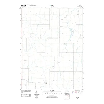
2010 Map of Clio
USGS Topo · Published 2010About this map
Clio and the surrounding township are defined by a rhythmic grid of rural roads and the branching headwaters of several major regional drainage systems. Located just north of the Missouri border, the area is situated where the South Fork Chariton River and the various forks of Medicine Creek—including the West Fork Medicine Creek and Middle Fork Medicine Creek—begin to carve into the southern Iowa landscape. The settlement at Clio is the primary hub, anchored by the Clio Post Office, while the western edge of Allerton and the small locality of Hodge provide further points of reference for the early 21st-century agricultural community.
Find a feature on this map
29 named features on this map. Tap any name to fly to it.
Don’t see what you’re looking for? This feature index may not catch every label — zoom into the map to look around manually.
Map Details
Editions of this 2010 Clio Map
This is the sole edition of this map. No revisions or reprints were ever made.
Other maps of this area

1934 · Humeston
USGS Topo · 1:48,000

1937 · Corydon
USGS Topo · 1:62,500

1954 · Centerville
USGS Topo · 1:250,000

1957 · Centerville
USGS Topo · 1:250,000

1958 · Centerville
USGS Topo · 1:250,000

1964 · Woodland
USGS Topo · 1:24,000

1964 · Allerton
USGS Topo · 1:24,000

1964 · Cleopatra
USGS Topo · 1:24,000

1964 · Clio
USGS Topo · 1:24,000
1964 · Powersville
USGS Topo · 1:24,000