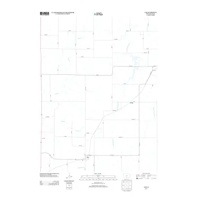
2013 Map of Clio
USGS Topo · Published 2013About this map
Clio serves as the primary settlement in this corner of Wayne County, Iowa, centered at the intersection of Co HWY-j54 and Main St. The landscape is defined by the headwaters and tributaries of several southward-flowing streams, including the S Fork Chariton River, W Fork Medicine Cr, and Turkey Cr. These waterways create a rolling agricultural terrain marked by a grid of rural roads like Garden Rd and King Rd. To the northeast, the smaller locality of Hodge sits near the crossing of Howe road, illustrating the dispersed nature of Iowa's rural hamlets in the early 21st century. The map provides a detailed view of the local infrastructure, from the residential layout along School St to the section-line boundaries that have organized this prairie landscape for generations.
Find a feature on this map
46 named features on this map. Tap any name to fly to it.
Don’t see what you’re looking for? This feature index may not catch every label — zoom into the map to look around manually.
Map Details
Editions of this 2013 Clio Map
This is the sole edition of this map. No revisions or reprints were ever made.
Other maps of this area

1934 · Humeston
USGS Topo · 1:48,000

1937 · Corydon
USGS Topo · 1:62,500

1954 · Centerville
USGS Topo · 1:250,000

1957 · Centerville
USGS Topo · 1:250,000

1958 · Centerville
USGS Topo · 1:250,000

1964 · Woodland
USGS Topo · 1:24,000

1964 · Allerton
USGS Topo · 1:24,000

1964 · Cleopatra
USGS Topo · 1:24,000

1964 · Clio
USGS Topo · 1:24,000
1964 · Powersville
USGS Topo · 1:24,000