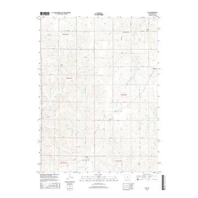
2015 Map of Clio
USGS Topo · Published 2015About this map
The settlement of Allerton sits on the eastern edge of this Wayne County landscape, where the prairie begins its descent into a complex network of creek valleys and river forks. In the south, the community of Clio is situated near Little Muddy Cr, surrounded by a rural grid of roads like Central Ave and Euclid. The terrain is defined by the drainage systems of the S Fork Chariton River and the various branches of Medicine Creek, including the W Fork Medicine Cr and Middle Fork Medicine Cr. These waterways create a rolling topography that has influenced the placement of early local landmarks. Genealogists and local historians will find several well-preserved burial sites documented across the townships, such as Hazel Dell Cem, Higley Cem, Greenridge Cem, and Clio Cem, each serving as a point of reference for the families who settled this part of southern Iowa.
Find a feature on this map
30 named features on this map. Tap any name to fly to it.
Don’t see what you’re looking for? This feature index may not catch every label — zoom into the map to look around manually.
Map Details
Editions of this 2015 Clio Map
This is the sole edition of this map. No revisions or reprints were ever made.
Other maps of this area

1934 · Humeston
USGS Topo · 1:48,000

1937 · Corydon
USGS Topo · 1:62,500

1954 · Centerville
USGS Topo · 1:250,000

1957 · Centerville
USGS Topo · 1:250,000

1958 · Centerville
USGS Topo · 1:250,000

1964 · Woodland
USGS Topo · 1:24,000

1964 · Allerton
USGS Topo · 1:24,000

1964 · Cleopatra
USGS Topo · 1:24,000

1964 · Clio
USGS Topo · 1:24,000
1964 · Powersville
USGS Topo · 1:24,000