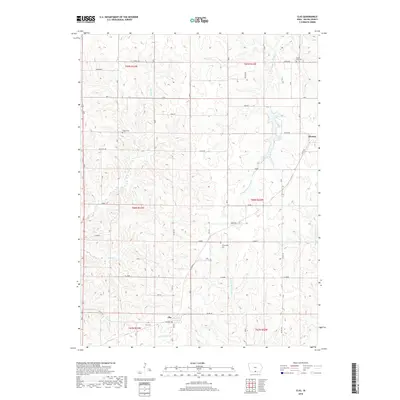
2018 Map of Clio
USGS Topo · Published 2018About this map
Clio and the southwestern edge of Allerton anchor this survey of southern Wayne County, Iowa, reflecting a landscape defined by the precision of the Public Land Survey System and its intersection with natural drainages. The area is marked by a network of waterways including the S Fork Chariton River and the West and Middle Forks of Medicine Creek, which carve modest valleys through the agrarian grid.
Find a feature on this map
31 named features on this map. Tap any name to fly to it.
Don’t see what you’re looking for? This feature index may not catch every label — zoom into the map to look around manually.
Map Details
Editions of this 2018 Clio Map
This is the sole edition of this map. No revisions or reprints were ever made.
Other maps of this area

1934 · Humeston
USGS Topo · 1:48,000

1937 · Corydon
USGS Topo · 1:62,500

1954 · Centerville
USGS Topo · 1:250,000

1957 · Centerville
USGS Topo · 1:250,000

1958 · Centerville
USGS Topo · 1:250,000

1964 · Woodland
USGS Topo · 1:24,000

1964 · Allerton
USGS Topo · 1:24,000

1964 · Cleopatra
USGS Topo · 1:24,000

1964 · Clio
USGS Topo · 1:24,000
1964 · Powersville
USGS Topo · 1:24,000