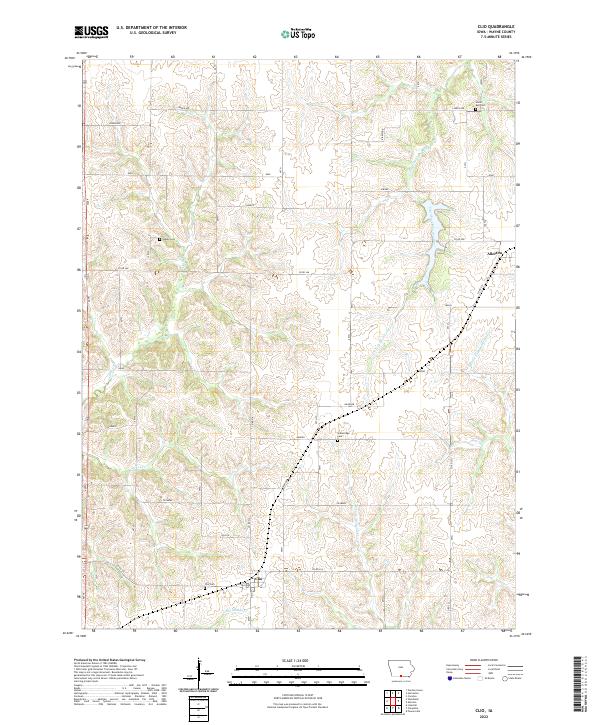
2022 Map of Clio
USGS Topo · Published 2022About this map
Wayne County's agricultural identity is clearly defined here through the extensive section-line road network and the drainage basins of the South Fork Chariton River and the Medicine Creek forks. The township of Allerton stands near the northeastern corner, serving as a focal point for the surrounding rural sections. The landscape is dotted with small, family-associated or community burial grounds, providing significant genealogical landmarks for those tracing local heritage. These include Clio Cem, Hazel Dell Cem, Greenridge Cem, and Higley Cem. The geography is characterized by the subtle divide between north-flowing and south-flowing waters, with Little Muddy Cr and W Fork Medicine Cr cutting through the southern townships, reflecting a terrain that has long dictated the layout of local farms and transport routes like Co Rd J46.
Find a feature on this map
30 named features on this map. Tap any name to fly to it.
Don’t see what you’re looking for? This feature index may not catch every label — zoom into the map to look around manually.
Map Details
Editions of this 2022 Clio Map
This is the sole edition of this map. No revisions or reprints were ever made.
Other maps of this area

1934 · Humeston
USGS Topo · 1:48,000

1937 · Corydon
USGS Topo · 1:62,500

1954 · Centerville
USGS Topo · 1:250,000

1957 · Centerville
USGS Topo · 1:250,000

1958 · Centerville
USGS Topo · 1:250,000

1964 · Woodland
USGS Topo · 1:24,000

1964 · Allerton
USGS Topo · 1:24,000

1964 · Cleopatra
USGS Topo · 1:24,000

1964 · Clio
USGS Topo · 1:24,000
1964 · Powersville
USGS Topo · 1:24,000