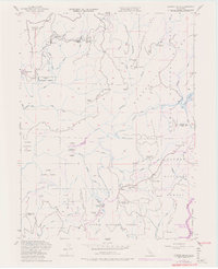
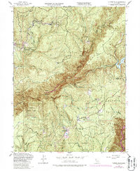
1948 Map of Clipper Mills
USGS Topo · Published 1978About this map
Clipper Mills and its surrounding ridge lands represent a transitional era in Northern California, where high-altitude ranching and mining met emerging water management projects. Settled along the Mooreville Ridge, the community supported local education at the Clipper Mills School and provided a hub for nearby timber and ranching operations like Maynards Ranch and Bean Ranch. The map records a complex network of resource extraction and infrastructure, from the Triumph Mine (Inactive) and Monte de Oro Mine to the water-diversion systems of the Lost Creek Canal and the Forbestown Diversion Dam. The rugged drainage of the Middle Fork Feather River and the South Fork Feather River dominates the terrain, illustrating the geographic challenges faced by early settlements like Lumpkin and Bogerville as they established themselves within the Plumas National Forest.
Find a feature on this map
61 named features on this map. Tap any name to fly to it.
Don’t see what you’re looking for? This feature index may not catch every label — zoom into the map to look around manually.
Map Details
Editions of this 1948 Clipper Mills Map
5 editions found
Other maps of this area

1888 · Smartsville
USGS Topo · 1:125,000

1888 · Bidwell Bar
USGS Topo · 1:125,000

1891 · Bidwell Bar
USGS Topo · 1:125,000

1891 · Smartsville
USGS Topo · 1:125,000

1892 · Smartsville
USGS Topo · 1:125,000

1893 · Bidwell Bar
USGS Topo · 1:125,000

1894 · Smartsville
USGS Topo · 1:125,000

1895 · Bidwell Bar
USGS Topo · 1:125,000

1895 · Smartsville
USGS Topo · 1:125,000

1897 · Bidwell Bar
USGS Topo · 1:125,000