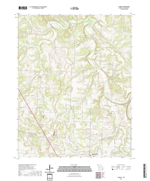
2021 Map of Cliquot
USGS Topo · Published 2021About this map
Cliquot stands as a focal point in this portion of Polk County, where the rural landscape is defined by the winding course of the Pomme de Terre River and its numerous tributaries. The area's agricultural and social history is preserved through several family and community burial grounds, including Morgan Cem in the north and Mount Olive Cem to the southeast. The drainage patterns are intricate, with Ashlock Creek and the W Fork Dry Fork carving through the terrain alongside smaller runs like Spoon Br and Abels Br. The southern edge of the map transitions toward the northern outskirts of Bolivar, illustrating the proximity of these rural communities to the regional county seat. A well-developed network of secondary roads and state routes, including State Hwy O and State Hwy B, provides clear context for the modern parcel divisions and land use in this Ozark foothills region.
Find a feature on this map
77 named features on this map. Tap any name to fly to it.
Don’t see what you’re looking for? This feature index may not catch every label — zoom into the map to look around manually.
Map Details
Editions of this 2021 Cliquot Map
This is the sole edition of this map. No revisions or reprints were ever made.
Other maps of this area

1884 · Bolivar
USGS Topo · 1:125,000

1886 · Stockton
USGS Topo · 1:125,000

1892 · Bolivar
USGS Topo · 1:125,000

1942 · Elkton
USGS Topo · 1:24,000

1944 · Humansville
USGS Topo · 1:24,000

1949 · Elkton
USGS Topo · 1:24,000

1949 · Sentinel
USGS Topo · 1:24,000

1950 · Elkton
USGS Topo · 1:24,000

1950 · Sentinel
USGS Topo · 1:24,000

1950 · Polk
USGS Topo · 1:24,000