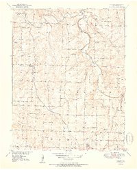
1951 Map of Cliquot
USGS Topo · Published 1951About this map
The St Louis - San Francisco railroad cuts a diagonal path through the rural landscape of Polk County, Missouri, anchoring the small settlement of Cliquot. This 1951 survey captures a period when rural schoolhouses and neighborhood churches still served as the primary social nodes for the farming community. Dozens of small landmarks are scattered across the terrain, including Union Grove Sch, Heydon Sch, and Mt Etna Sch, alongside several family and community burial grounds such as Morgan Cem and Richardson Cem.
Find a feature on this map
36 named features on this map. Tap any name to fly to it.
Don’t see what you’re looking for? This feature index may not catch every label — zoom into the map to look around manually.
Map Details
Editions of this 1951 Cliquot Map
2 editions found
Other maps of this area

1884 · Bolivar
USGS Topo · 1:125,000

1886 · Stockton
USGS Topo · 1:125,000

1892 · Bolivar
USGS Topo · 1:125,000

1942 · Elkton
USGS Topo · 1:24,000

1944 · Humansville
USGS Topo · 1:24,000

1949 · Elkton
USGS Topo · 1:24,000

1949 · Sentinel
USGS Topo · 1:24,000

1950 · Elkton
USGS Topo · 1:24,000

1950 · Sentinel
USGS Topo · 1:24,000

1950 · Polk
USGS Topo · 1:24,000