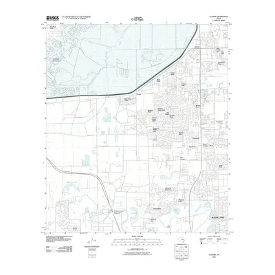
2010 Map of Clodine
USGS Topo · Published 2010About this map
Barker Dam and its adjacent reservoir lands dominate the northern landscape of this 2010 survey, illustrating the critical water management infrastructure protecting the western Houston suburbs. The map captures an era of rapid suburban expansion, where residential developments like Mission Bend and Four Corners have largely replaced the former agricultural lands of eastern Fort Bend County. This development pattern is particularly evident along the Buffalo Bayou and Brays Bayou corridors, where neighborhood names like Mission West and Chelsea at Mission Bend reflect the modern subdivision of the terrain.
Find a feature on this map
68 named features on this map. Tap any name to fly to it.
Don’t see what you’re looking for? This feature index may not catch every label — zoom into the map to look around manually.
Map Details
Editions of this 2010 Clodine Map
This is the sole edition of this map. No revisions or reprints were ever made.
Other maps of this area

1915 · Alief
USGS Topo · 1:24,000

1915 · Katy
USGS Topo · 1:24,000

1915 · Addicks
USGS Topo · 1:24,000

1915 · Hillendahl
USGS Topo · 1:24,000

1915 · Clodine
USGS Topo · 1:24,000

1918 · Addicks
USGS Topo · 1:31,680

1918 · Hillendahl
USGS Topo · 1:31,680

1919 · Clodine
USGS Topo · 1:31,680

1950 · Houston
USGS Topo · 1:250,000
1955 · Addicks
USGS Topo · 1:62,500