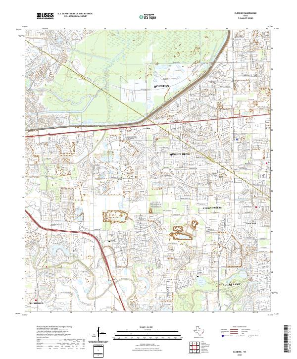
2022 Map of Clodine
USGS Topo · Published 2022About this map
The Harris Co Fort Bend Co line bisects this landscape of suburban expansion and historical enclaves west of Houston. Centered on the community of Clodine, the map documents a transition from established settlements to modern residential developments. Cultural landmarks such as the McGee Chapel Missionary Baptist Church and Pleasant Green Cem anchor the social history of the region, while the Hodges Bend Cem near the banks of Oyster Creek provides a genealogical link to early area families.
Find a feature on this map
35 named features on this map. Tap any name to fly to it.
Don’t see what you’re looking for? This feature index may not catch every label — zoom into the map to look around manually.
Map Details
Editions of this 2022 Clodine Map
This is the sole edition of this map. No revisions or reprints were ever made.
Other maps of this area

1915 · Alief
USGS Topo · 1:24,000

1915 · Katy
USGS Topo · 1:24,000

1915 · Addicks
USGS Topo · 1:24,000

1915 · Hillendahl
USGS Topo · 1:24,000

1915 · Clodine
USGS Topo · 1:24,000

1918 · Addicks
USGS Topo · 1:31,680

1918 · Hillendahl
USGS Topo · 1:31,680

1919 · Clodine
USGS Topo · 1:31,680

1950 · Houston
USGS Topo · 1:250,000
1955 · Addicks
USGS Topo · 1:62,500