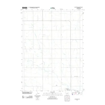
2011 Map of Closter SE
USGS Topo · Published 2011About this map
Newman Grove sits at the southern edge of this Madison County landscape, where the agricultural grid is defined by a dense network of sectional roads and meandering waterways. The drainage pattern of the region is dominated by Shell Creek and its tributary North Shell Creek, which cut irregular paths across the surveyed farmland. These creek beds provide the primary topographic relief in an area otherwise dedicated to large-scale cultivation.
Find a feature on this map
18 named features on this map. Tap any name to fly to it.
Don’t see what you’re looking for? This feature index may not catch every label — zoom into the map to look around manually.
Map Details
Editions of this 2011 Closter SE Map
This is the sole edition of this map. No revisions or reprints were ever made.
Other maps of this area

1955 · Fremont
USGS Topo · 1:250,000

1957 · Fremont
USGS Topo · 1:250,000

1958 · Fremont
USGS Topo · 1:250,000

1958 · Albion East
USGS Topo · 1:24,000

1963 · Closter SW
USGS Topo · 1:24,000

1963 · Emerick
USGS Topo · 1:24,000

1963 · Closter SE
USGS Topo · 1:24,000
1963 · Closter
USGS Topo · 1:24,000
1963 · Closter NE
USGS Topo · 1:24,000

1963 · Battle Creek SW
USGS Topo · 1:24,000