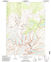
1993 Map of Cloud Peak
USGS Topo · Published 1997About this map
Cloud Peak dominates this high-altitude landscape, anchoring a massive granite crest within the Bighorn National Forest. The topography is defined by the sharp verticality of the Bighorn Mountains, where prominent summits like Black Tooth Mountain and Mt Woolsey overlook a dense network of glacial lakes and alpine basins. The central portion of the map is protected as the Cloud Peak Wilderness, an area where natural drainage patterns and pack trails dictate movement across the terrain.
Find a feature on this map
49 named features on this map. Tap any name to fly to it.
Don’t see what you’re looking for? This feature index may not catch every label — zoom into the map to look around manually.
Map Details
Editions of this 1993 Cloud Peak Map
This is the sole edition of this map. No revisions or reprints were ever made.
Other maps of this area

1895 · Dayton
USGS Topo · 1:125,000

1899 · Cloud peak
USGS Topo · 1:125,000

1901 · Cloud Peak
USGS Topo · 1:125,000

1901 · Dayton
USGS Topo · 1:125,000

1955 · Sheridan
USGS Topo · 1:250,000

1958 · Sheridan
USGS Topo · 1:250,000

1960 · Shell Lake
USGS Topo · 1:24,000

1960 · Lake Solitude
USGS Topo · 1:24,000

1962 · Sheridan
USGS Topo · 1:250,000
1964 · Dome Lake
USGS Topo · 1:24,000