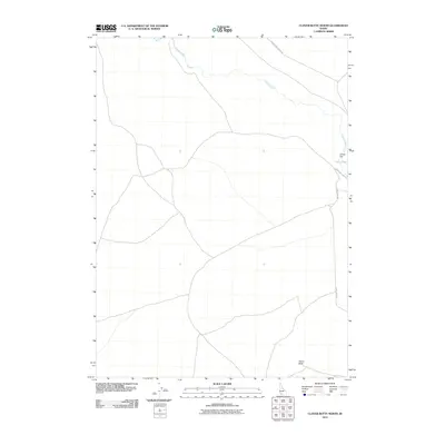
2010 Map of Clover Butte North
USGS Topo · Published 2010About this map
Clover Creek meanders through this portion of Owyhee County, defining the drainage patterns of an arid landscape punctuated by volcanic landmarks. The geography is anchored by Clover Flat and the prominent rising of Clover Butte to the south, reflecting the characteristic basaltic and high-desert terrain of the region. Transportation in this area relies on a network of sparse gravel and dirt roads, most notably Clover Three Creek Rd and Three Creek Rd, which provide access to this isolated part of southern Idaho. The map reveals a land primarily shaped by topography rather than dense settlement, offering researchers a look at how geographic features like the butte and creek have dictated the placement of local thoroughfares.
Find a feature on this map
8 named features on this map. Tap any name to fly to it.
Don’t see what you’re looking for? This feature index may not catch every label — zoom into the map to look around manually.
Map Details
Editions of this 2010 Clover Butte North Map
This is the sole edition of this map. No revisions or reprints were ever made.
Other maps of this area

1955 · Twin Falls
USGS Topo · 1:250,000

1956 · Blue Butte
USGS Topo · 1:62,500

1956 · Winter Camp
USGS Topo · 1:62,500

1958 · Twin Falls
USGS Topo · 1:250,000

1979 · Stiff Tree Draw
USGS Topo · 1:24,000

1979 · Clover Butte South
USGS Topo · 1:24,000
1979 · Inside Lakes
USGS Topo · 1:24,000

1980 · Juniper Butte
USGS Topo · 1:24,000

1980 · Clover Butte North
USGS Topo · 1:24,000
1980 · Juniper Ranch
USGS Topo · 1:24,000