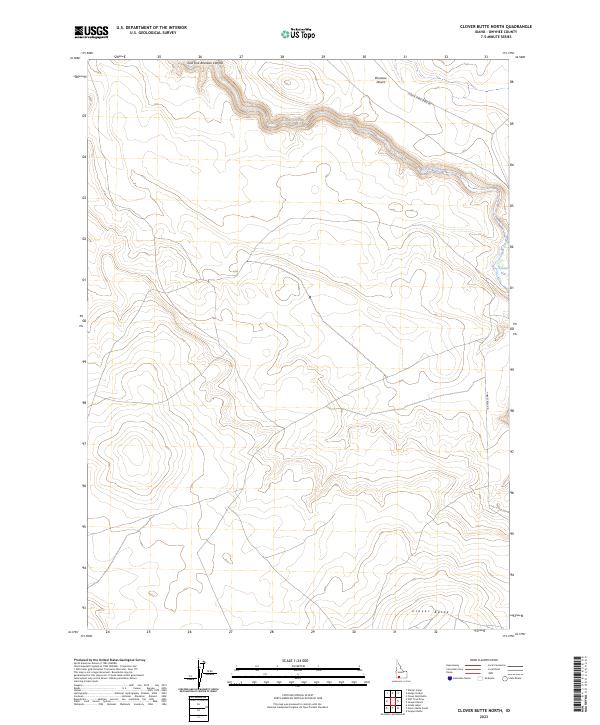
2023 Map of Clover Butte North
USGS Topo · Published 2023About this map
The East Fork Bruneau Canyon carves a deep path across the northern reaches of this landscape, defining the transition from the arid Bruneau Desert to the elevated terrain further south. This high-desert environment in Owyhee County is characterized by significant natural landmarks including Clover Butte in the southeast and the broad expanse of Clover Flat to the east. Water resources in this dry region are centered on the winding course of Clover Creek. Transportation across this remote area is facilitated by two primary routes, Clover Three Creek Rd and Three Creek Rd, which provide access to the disparate sections of the canyon and the plateau. The map illustrates a landscape primarily shaped by its dramatic geology and the essential role of limited water sources in an otherwise desert environment.
Find a feature on this map
11 named features on this map. Tap any name to fly to it.
Don’t see what you’re looking for? This feature index may not catch every label — zoom into the map to look around manually.
Map Details
Editions of this 2023 Clover Butte North Map
This is the sole edition of this map. No revisions or reprints were ever made.
Other maps of this area

1955 · Twin Falls
USGS Topo · 1:250,000

1956 · Blue Butte
USGS Topo · 1:62,500

1956 · Winter Camp
USGS Topo · 1:62,500

1958 · Twin Falls
USGS Topo · 1:250,000

1979 · Stiff Tree Draw
USGS Topo · 1:24,000

1979 · Clover Butte South
USGS Topo · 1:24,000
1979 · Inside Lakes
USGS Topo · 1:24,000

1980 · Juniper Butte
USGS Topo · 1:24,000

1980 · Clover Butte North
USGS Topo · 1:24,000
1980 · Juniper Ranch
USGS Topo · 1:24,000