
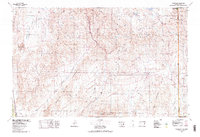
1978 Map of Clover Mts
USGS Topo · Published 1978About this map
The Union Pacific rail line threads through the heart of this high desert terrain, following the winding path of Rainbow Canyon past the isolated stops of Elgin, Carp, and Vigo. This 1978 edition illustrates a landscape defined by dramatic basin-and-range topography, where the Clover Mountains and Delamar Mountains are separated by broad expanses like Kane Springs Valley and the Tule Desert.
Find a feature on this map
50 named features on this map. Tap any name to fly to it.
Don’t see what you’re looking for? This feature index may not catch every label — zoom into the map to look around manually.
Map Details
Editions of this 1978 Clover Mts Map
2 editions found
Other maps of this area

1885 · St. George
USGS Topo · 1:250,000

1885 · Pioche
USGS Topo · 1:250,000

1886 · Saint Thomas
USGS Topo · 1:250,000

1886 · Mt. Trumbull
USGS Topo · 1:250,000

1886 · Pioche
USGS Topo · 1:250,000

1891 · St. George
USGS Topo · 1:250,000

1892 · Mt. Trumbull
USGS Topo · 1:250,000

1893 · Saint Thomas
USGS Topo · 1:250,000

1907 · Las Vegas
USGS Topo · 1:250,000

1908 · Las Vegas
USGS Topo · 1:250,000