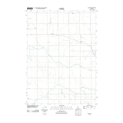
2010 Map of Clover
USGS Topo · Published 2010About this map
The agricultural landscape of the Snake River Plain near Buhl is defined by a rigorous grid of section lines and the vital infrastructure of the High Line Canal and Low Line Canal. These irrigation systems support small rural communities and cross-road settlements like Clover, Cedar, and Peavey. The map documents a well-established agrarian society, anchored by local institutions such as the Cedar Draw School in the north and Superior School in the southwest. The presence of Buhl Cemetery on the western edge near Elm St further underscores the deep local roots in this corner of Twin Falls County. The settlement pattern follows the predictable geometry of the township and range system, with numbered roads such as N 2000 E and E 4000 N providing the framework for farm access and transport across the Idaho countryside.
Find a feature on this map
30 named features on this map. Tap any name to fly to it.
Don’t see what you’re looking for? This feature index may not catch every label — zoom into the map to look around manually.
Map Details
Editions of this 2010 Clover Map
This is the sole edition of this map. No revisions or reprints were ever made.
Other maps of this area

1949 · Thousand Springs
USGS Topo · 1:24,000

1950 · Niagara Springs
USGS Topo · 1:24,000

1950 · Filer
USGS Topo · 1:24,000

1950 · Jerome
USGS Topo · 1:24,000

1950 · Jerome
USGS Topo · 1:62,500

1951 · Thousand Springs
USGS Topo · 1:24,000

1951 · Clover
USGS Topo · 1:24,000

1954 · Thousand Springs
USGS Topo · 1:24,000

1955 · Twin Falls
USGS Topo · 1:250,000

1958 · Twin Falls
USGS Topo · 1:250,000