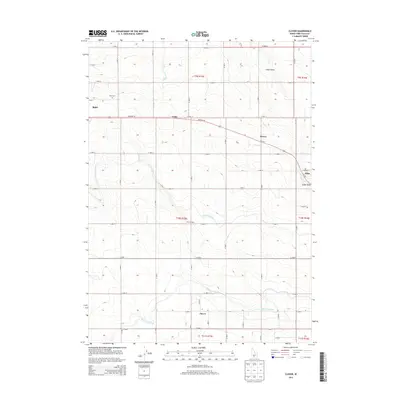
2013 Map of Clover
USGS Topo · Published 2013About this map
Agricultural development in Twin Falls County is clearly defined on this 2013 survey by the systematic grid of irrigation channels. The High Line Canal and Low Line Canal run northwest to southeast, providing the essential water infrastructure that sustains the surrounding farmsteads and operations like Frontier Dairy. This network of man-made waterways contrasts with the natural drainage of Cedar Draw, which cuts through the northeastern corner of the map near Filer.
Find a feature on this map
21 named features on this map. Tap any name to fly to it.
Don’t see what you’re looking for? This feature index may not catch every label — zoom into the map to look around manually.
Map Details
Editions of this 2013 Clover Map
This is the sole edition of this map. No revisions or reprints were ever made.
Other maps of this area

1949 · Thousand Springs
USGS Topo · 1:24,000

1950 · Niagara Springs
USGS Topo · 1:24,000

1950 · Filer
USGS Topo · 1:24,000

1950 · Jerome
USGS Topo · 1:24,000

1950 · Jerome
USGS Topo · 1:62,500

1951 · Thousand Springs
USGS Topo · 1:24,000

1951 · Clover
USGS Topo · 1:24,000

1954 · Thousand Springs
USGS Topo · 1:24,000

1955 · Twin Falls
USGS Topo · 1:250,000

1958 · Twin Falls
USGS Topo · 1:250,000