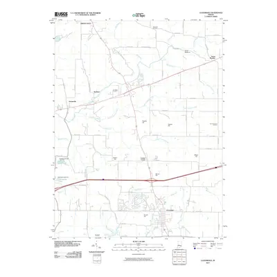
2010 Map of Cloverdale
USGS Topo · Published 2010About this map
Cloverdale serves as a central hub in this Putnam County landscape, where the intersection of major transit routes meets a network of rural county roads like Possum Holler Rd. The terrain is defined by numerous drainage systems, including Deer Creek and its many tributaries such as Wallace Branch and Little Deer Creek, which carve through the land near prominent elevations like Devils Backbone and Hughes Hill.
Find a feature on this map
68 named features on this map. Tap any name to fly to it.
Don’t see what you’re looking for? This feature index may not catch every label — zoom into the map to look around manually.
Map Details
Editions of this 2010 Cloverdale Map
This is the sole edition of this map. No revisions or reprints were ever made.
Other maps of this area

1949 · Quincy
USGS Topo · 1:24,000

1951 · Clinton Falls
USGS Topo · 1:24,000

1952 · Reelsville
USGS Topo · 1:24,000

1953 · Indianapolis
USGS Topo · 1:250,000

1956 · Indianapolis
USGS Topo · 1:250,000

1956 · Cloverdale
USGS Topo · 1:24,000

1956 · Cataract
USGS Topo · 1:24,000

1956 · Eminence
USGS Topo · 1:24,000

1957 · Indianapolis
USGS Topo · 1:250,000
1957 · Poland
USGS Topo · 1:24,000