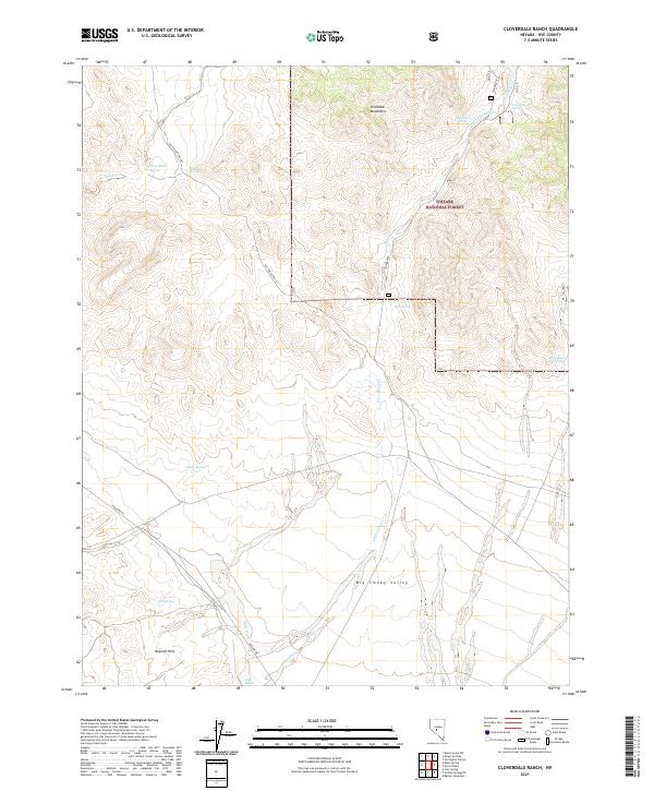
2021 Map of Cloverdale Ranch
USGS Topo · Published 2021About this map
The Toiyabe National Forest covers much of this high-desert landscape in Nye County, where the Shoshone Mountains descend toward the broad expanse of the Big Smoky Valley. This region is defined by its critical water sources, with a network of vital points such as West Willow Spring, Fourmile Spring, Yellow Spring, and Red Spring scattered across the arid terrain. The presence of Cloverdale Creek and its seasonal drainages like Golden Wash and Long Wash indicate the complex hydrology of this part of the Great Basin. Remote access is provided by primitive routes such as Poleline Rd and Nat For Dev Rd 427, which traverse the southern reaches near the Royston Hills, reflecting a landscape primarily shaped by cattle ranching and natural resource management.
Find a feature on this map
36 named features on this map. Tap any name to fly to it.
Don’t see what you’re looking for? This feature index may not catch every label — zoom into the map to look around manually.
Map Details
Editions of this 2021 Cloverdale Ranch Map
This is the sole edition of this map. No revisions or reprints were ever made.
Other maps of this area

1907 · Tonopah
USGS Topo · 1:250,000

1908 · Tonopah
USGS Topo · 1:250,000

1956 · Tonopah
USGS Topo · 1:250,000

1959 · Tonopah
USGS Topo · 1:250,000

1962 · Tonopah
USGS Topo · 1:250,000

1964 · San Antonio Ranch
USGS Topo · 1:62,500

1980 · Cole Spring
USGS Topo · 1:24,000
1980 · Cloverdale Ranch
USGS Topo · 1:24,000
1980 · Outlaw Springs NE
USGS Topo · 1:24,000
1980 · Black Spring NW
USGS Topo · 1:24,000