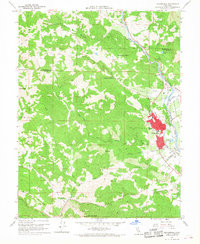
1960 Map of Cloverdale
USGS Topo · Published 1968About this map
Cloverdale sits at the nexus of the Alexander Valley and Oat Valley, serving as a vital hub for the northern Sonoma County agricultural region. The Northwestern Pacific railroad corridor parallels the Russian River, defining the transportation spine that historically linked the settlement of Preston and the surrounding ranching lands. This 1960s-era landscape reveals a community structure centered on institutional landmarks like the High Sch and Cem, while the outskirts are shaped by significant geographic features such as Redwood Mtn and Thompson Ridge.
Find a feature on this map
42 named features on this map. Tap any name to fly to it.
Don’t see what you’re looking for? This feature index may not catch every label — zoom into the map to look around manually.
Map Details
Editions of this 1960 Cloverdale Map
4 editions found
Other maps of this area

1920 · Healdsburg
USGS Topo · 1:62,500

1921 · Skaggs
USGS Topo · 1:62,500

1921 · Kelseyville
USGS Topo · 1:62,500

1933 · Healdsburg
USGS Topo · 1:48,000

1938 · Hopland
USGS Topo · 1:62,500

1940 · Healdsburg
USGS Topo · 1:62,500

1943 · Tombs Creek
USGS Topo · 1:24,000

1943 · Skaggs Springs
USGS Topo · 1:24,000

1943 · Kelseyville
USGS Topo · 1:62,500

1943 · Hopland
USGS Topo · 1:62,500