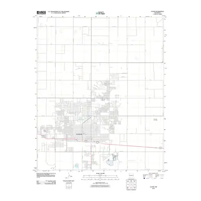
2010 Map of Clovis
USGS Topo · Published 2010About this map
Clovis dominates the Llano Estacado in this high-plains landscape, showing its development as a major regional hub. The map illustrates a grid-heavy urban center that transitions into structured agricultural sections, bounded by a network of rural routes such as County Rd 16 and County Rd 8. Civic and logistical infrastructure is well-defined, including the centrally located Clovis Post Office and the Aero Tech Inc Airport on the eastern edge of the city. Notable local landmarks for genealogists include Lawn Haven Cemetery and Mission Garden Cemetery, which serve as significant historical anchors for the community. The presence of Greene Lake and Santa Fe Lake provides a glimpse into the managed water resources essential for this arid environment, while the extensive road network, featuring S Main St and Norris St, highlights the town's role as a transit crossroads in Eastern New Mexico.
Find a feature on this map
35 named features on this map. Tap any name to fly to it.
Don’t see what you’re looking for? This feature index may not catch every label — zoom into the map to look around manually.
Map Details
Editions of this 2010 Clovis Map
This is the sole edition of this map. No revisions or reprints were ever made.
Other maps of this area

1954 · Clovis
USGS Topo · 1:250,000

1957 · Portair
USGS Topo · 1:62,500

1957 · Clovis
USGS Topo · 1:62,500

1957 · Pleasant Hill
USGS Topo · 1:62,500

1957 · Hammond Ranch
USGS Topo · 1:62,500

1958 · Clovis
USGS Topo · 1:250,000

1985 · Portair
USGS Topo · 1:24,000

1985 · Midway
USGS Topo · 1:24,000

1985 · Pleasure Lake
USGS Topo · 1:24,000

1985 · Pleasant Hill
USGS Topo · 1:24,000