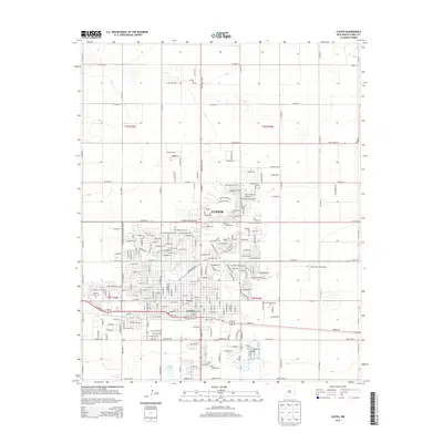
2013 Map of Clovis
USGS Topo · Published 2013About this map
Clovis serves as the central hub of this eastern New Mexico survey, illustrating the city's modern street grid and its expansion into Curry County. The urban layout is punctuated by essential civic and community landmarks, including Clovis Community College and Aero Tech Inc Airport, which underscore the region's educational and aviation infrastructure. Local history and genealogy researchers will find clear locations for Lawn Haven Cem and Mission Garden Cem, situated on opposite sides of the city. The arid High Plains landscape is dotted with modest water features such as Greene Lake and Santa Fe Lake, while major thoroughfares like Mabry Dr and E Grand Ave define the primary transit corridors. This edition documents the township and range boundaries of t3n r36e and surrounding sections during a period of steady residential and commercial development.
Find a feature on this map
31 named features on this map. Tap any name to fly to it.
Don’t see what you’re looking for? This feature index may not catch every label — zoom into the map to look around manually.
Map Details
Editions of this 2013 Clovis Map
This is the sole edition of this map. No revisions or reprints were ever made.
Other maps of this area

1954 · Clovis
USGS Topo · 1:250,000

1957 · Portair
USGS Topo · 1:62,500

1957 · Clovis
USGS Topo · 1:62,500

1957 · Pleasant Hill
USGS Topo · 1:62,500

1957 · Hammond Ranch
USGS Topo · 1:62,500

1958 · Clovis
USGS Topo · 1:250,000

1985 · Portair
USGS Topo · 1:24,000

1985 · Midway
USGS Topo · 1:24,000

1985 · Pleasure Lake
USGS Topo · 1:24,000

1985 · Pleasant Hill
USGS Topo · 1:24,000