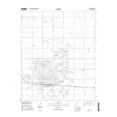
2017 Map of Clovis
USGS Topo · Published 2017About this map
Clovis serves as a critical railroad and agricultural hub in Curry County, shown here as a dense grid of residential streets and industrial corridors. The city's geography is defined by the BNSF Railway tracks and major thoroughfares like Mabry Drive and West Llano Estacado Boulevard. This modern survey illustrates the expansive reach of the community, from the residential developments near Greene Lake and Lawn Haven Cemetery to the educational campus of Clovis Community College. Outside the city limits, the landscape transitions into a vast section-line road network, including County Road 16 and County Road 8, reflecting the region's enduring commitment to large-scale agriculture. The presence of Santa Fe Lake to the south and Aero Tech Inc Airport to the east highlights the diverse land use surrounding this Eastern New Mexico urban center.
Find a feature on this map
30 named features on this map. Tap any name to fly to it.
Don’t see what you’re looking for? This feature index may not catch every label — zoom into the map to look around manually.
Map Details
Editions of this 2017 Clovis Map
This is the sole edition of this map. No revisions or reprints were ever made.
Other maps of this area

1954 · Clovis
USGS Topo · 1:250,000

1957 · Portair
USGS Topo · 1:62,500

1957 · Clovis
USGS Topo · 1:62,500

1957 · Pleasant Hill
USGS Topo · 1:62,500

1957 · Hammond Ranch
USGS Topo · 1:62,500

1958 · Clovis
USGS Topo · 1:250,000

1985 · Portair
USGS Topo · 1:24,000

1985 · Midway
USGS Topo · 1:24,000

1985 · Pleasure Lake
USGS Topo · 1:24,000

1985 · Pleasant Hill
USGS Topo · 1:24,000