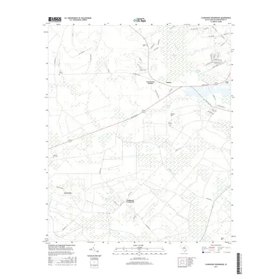
2017 Map of Clubhouse Crossroads
USGS Topo · Published 2017About this map
Ashley River drainage patterns and the low-lying wetlands of Cypress Swamp define the landscape of this Dorchester County locale. The map details a transition from the structured residential expansion seen near Hundred Oaks Pkwy and Boone Hill Rd to the more traditional rural clusters at Clubhouse Crossroads and Gettysville. These small settlements are anchored by historical community sites, including Shepherd Grove Cem and Rosom Hill Cem, which serve as vital markers for local genealogy. The network of roads, such as Walterboro Rd and Beech Hill Rd, connects these interior reaches to the broader region, while the hydrology of Marsh Pond, Schultz Lake, and the winding Ashburne Cr illustrates the coastal plain's natural water management. This 2017 survey provides a precise look at the area's development, documenting how newer thoroughfares like Fall Creek Blvd interface with established rural landmarks like Coachmans Corners.
Find a feature on this map
66 named features on this map. Tap any name to fly to it.
Don’t see what you’re looking for? This feature index may not catch every label — zoom into the map to look around manually.
Map Details
Editions of this 2017 Clubhouse Crossroads Map
This is the sole edition of this map. No revisions or reprints were ever made.
Other maps of this area

1918 · Cottageville
USGS Topo · 1:62,500

1919 · Summerville
USGS Topo · 1:48,000

1919 · Ridgeville
USGS Topo · 1:48,000

1920 · Ravenels
USGS Topo · 1:62,500

1920 · Ridgeville
USGS Topo · 1:62,500

1920 · Summerville
USGS Topo · 1:62,500

1943 · Cottageville
USGS Topo · 1:62,500

1943 · Ridgeville
USGS Topo · 1:62,500

1944 · Ravenels
USGS Topo · 1:62,500

1944 · Summerville
USGS Topo · 1:62,500