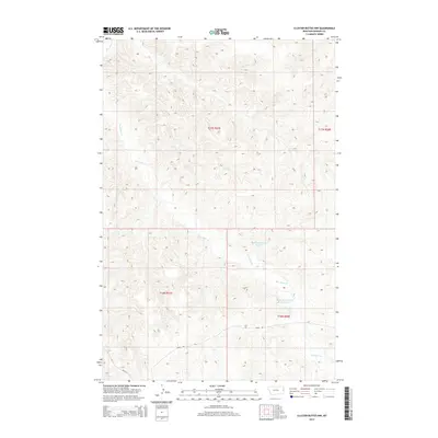
2014 Map of Cluster Buttes NW
USGS Topo · Published 2014About this map
Box Elder Cr meanders across this eastern Montana landscape, carving a drainage pattern through the breaks and uplands of Dawson County. The terrain is defined by its water management features, specifically Milliron Reservoir Number 1 and Milliron Reservoir Number 2, which capture seasonal runoff in an otherwise arid rangeland. These reservoirs and the surrounding drainage network indicate the area's primary utility for livestock grazing and land management. Transportation is limited to a sparse grid of section roads, including Road 322 and Road 328, which provide access through the sprawling townships of t17n r57e, t17n r58e, t16n r57e, and t16n r58e. The map reflects the vast, open character of the high plains, where human imprint is secondary to the natural contours and essential water sources.
Find a feature on this map
45 named features on this map. Tap any name to fly to it.
Don’t see what you’re looking for? This feature index may not catch every label — zoom into the map to look around manually.
Map Details
Editions of this 2014 Cluster Buttes NW Map
This is the sole edition of this map. No revisions or reprints were ever made.
Other maps of this area

1909 · Glendive
USGS Topo · 1:250,000

1954 · Glendive
USGS Topo · 1:250,000

1957 · Glendive
USGS Topo · 1:250,000

1958 · Glendive
USGS Topo · 1:250,000

1966 · Savage SE
USGS Topo · 1:24,000

1966 · Savage SW
USGS Topo · 1:24,000

1966 · Intake
USGS Topo · 1:24,000

1967 · Allard
USGS Topo · 1:24,000

1967 · Belle Prairie
USGS Topo · 1:24,000

1981 · Glendive
USGS Topo · 1:100,000