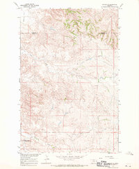
1966 Map of Savage SE
USGS Topo · Published 1970About this map
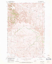
Valentine Flat and the rugged drainage systems of the Montana badlands define this mid-1960s survey, conducted as part of the Department of the Interior's Missouri River Basin development program. The landscape is characterized by deeply eroded coulees and canyons, notably Devils Canyon, which slice through the high plains. The topography reveals a sparsely populated area where natural watercourses like Dry Creek and the North Fork and South Fork provide the primary geographic structure. Evidence of local industry is minimal but present, indicated by a Gravel Pit and a lone Well, reflecting the region's reliance on ranching and resource extraction. The map also delineates the meeting of three administrative boundaries, marking the intersections of Richland, Dawson, and Wibaux counties.
Find a feature on this map
10 named features on this map. Tap any name to fly to it.
Don’t see what you’re looking for? This feature index may not catch every label — zoom into the map to look around manually.
Map Details
Editions of this 1966 Savage SE Map
This is the sole edition of this map. No revisions or reprints were ever made.
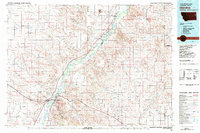
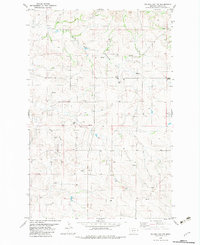
Other maps of this area

1909 · Glendive
USGS Topo · 1:250,000

1954 · Glendive
USGS Topo · 1:250,000

1957 · Glendive
USGS Topo · 1:250,000

1958 · Glendive
USGS Topo · 1:250,000
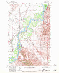
1966 · Savage
USGS Topo · 1:24,000
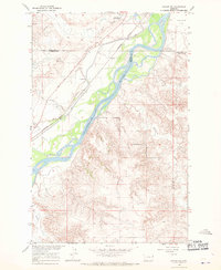
1966 · Savage SW
USGS Topo · 1:24,000
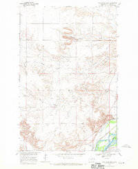
1966 · Knife River Mine
USGS Topo · 1:24,000
1966 · Skaar NW
USGS Topo · 1:24,000
1981 · Glendive
USGS Topo · 1:100,000
1982 · Odland Dam NW
USGS Topo · 1:24,000