
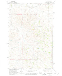
1966 Map of Skaar NW
USGS Topo · Published 1971About this map
Lindberg Hill rises above the high plains of Eastern Montana in this mid-1960s survey of the borderlands between Richland and Wibaux counties. This landscape is defined by the drainages of Shadwell Creek, Elm Coulee, and Smith Creek, which cut through the undulating terrain near the North Dakota State Line. The map reveals a sparse, rural pattern of settlement typical of the Missouri River Basin development era, where isolated resources and education centers like the Clark Sch served widely scattered ranching or farming families. Numerous Well sites and Gravel Pits indicate the localized industrial and agricultural activity supporting the region's economy at the time of the 1966 field check.
Find a feature on this map
10 named features on this map. Tap any name to fly to it.
Don’t see what you’re looking for? This feature index may not catch every label — zoom into the map to look around manually.
Map Details
Editions of this 1966 Skaar NW Map
This is the sole edition of this map. No revisions or reprints were ever made.
Other maps of this area

1909 · Glendive
USGS Topo · 1:250,000

1954 · Glendive
USGS Topo · 1:250,000

1957 · Glendive
USGS Topo · 1:250,000

1958 · Glendive
USGS Topo · 1:250,000

1966 · Savage
USGS Topo · 1:24,000

1966 · Savage SE
USGS Topo · 1:24,000

1966 · Piche
USGS Topo · 1:24,000

1966 · Crane
USGS Topo · 1:24,000

1972 · Sidney SE
USGS Topo · 1:24,000
1974 · Skaar
USGS Topo · 1:24,000