
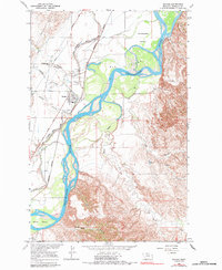
1966 Map of Savage
USGS Topo · Published 1970About this map
The Yellowstone River dominates this mid-1960s landscape, carving a braided path through Richland County with significant landforms like Elk Island, Crittenden Island, and Marys Island. The settlement of Savage sits on the western terrace, its local infrastructure marked by a High Sch and the Riverview Cem. This area demonstrates the critical role of water management in the high plains, evidenced by the extensive Main Canal and Usbr irrigation works designed for the Missouri River Basin's development.
Find a feature on this map
26 named features on this map. Tap any name to fly to it.
Don’t see what you’re looking for? This feature index may not catch every label — zoom into the map to look around manually.
Map Details
Editions of this 1966 Savage Map
2 editions found
Other maps of this area

1909 · Glendive
USGS Topo · 1:250,000

1954 · Glendive
USGS Topo · 1:250,000

1957 · Glendive
USGS Topo · 1:250,000

1958 · Glendive
USGS Topo · 1:250,000

1966 · Savage SE
USGS Topo · 1:24,000

1966 · Savage SW
USGS Topo · 1:24,000

1966 · Piche
USGS Topo · 1:24,000

1966 · Knife River Mine
USGS Topo · 1:24,000

1966 · Crane
USGS Topo · 1:24,000

1966 · Skaar NW
USGS Topo · 1:24,000