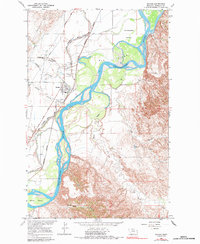
1966 Map of Savage
USGS Topo · Published 1984About this map
The Yellowstone River dominates this mid-1960s landscape, weaving through a complex of river islands including Elk Island, Crittenden Island, and Marys Island. The settlement of Savage serves as the focal point for the region's infrastructure, where the Burlington Northern railroad and the Lower Yellowstone Road Project Main Canal parallel the river's western bank. This canal system is a defining feature of the Richland County agricultural economy, supporting the flats and coulees that characterize the local terrain.
Find a feature on this map
26 named features on this map. Tap any name to fly to it.
Don’t see what you’re looking for? This feature index may not catch every label — zoom into the map to look around manually.
Map Details
Editions of this 1966 Savage Map
2 editions found
Other maps of this area

1909 · Glendive
USGS Topo · 1:250,000

1954 · Glendive
USGS Topo · 1:250,000

1957 · Glendive
USGS Topo · 1:250,000

1958 · Glendive
USGS Topo · 1:250,000

1966 · Savage
USGS Topo · 1:24,000

1966 · Savage SE
USGS Topo · 1:24,000

1966 · Savage SW
USGS Topo · 1:24,000

1966 · Piche
USGS Topo · 1:24,000

1966 · Knife River Mine
USGS Topo · 1:24,000

1966 · Crane
USGS Topo · 1:24,000