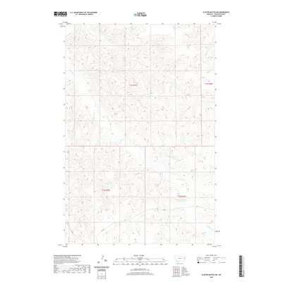
2020 Map of Cluster Buttes NW
USGS Topo · Published 2020About this map
Box Elder Creek meanders through this portion of Dawson County, carving a complex network of drainage patterns across the high plains. This landscape is defined by the practical water management systems of the cattle country, featuring Milliron Reservoir Number 1 and Milliron Reservoir Number 2. These reservoirs, likely tied to local ranching operations, serve as focal points in an otherwise arid terrain dominated by elevation contours. The map reflects the organized land partitioning of the Public Land Survey System, specifically within Townships 16 and 17 North. Remote access to this area is facilitated by a sparse network of county routes, including Road 328 and Road 322, which follow the natural topography of the divides and draws.
Find a feature on this map
9 named features on this map. Tap any name to fly to it.
Don’t see what you’re looking for? This feature index may not catch every label — zoom into the map to look around manually.
Map Details
Editions of this 2020 Cluster Buttes NW Map
This is the sole edition of this map. No revisions or reprints were ever made.
Other maps of this area

1909 · Glendive
USGS Topo · 1:250,000

1954 · Glendive
USGS Topo · 1:250,000

1957 · Glendive
USGS Topo · 1:250,000

1958 · Glendive
USGS Topo · 1:250,000

1966 · Savage SE
USGS Topo · 1:24,000

1966 · Savage SW
USGS Topo · 1:24,000

1966 · Intake
USGS Topo · 1:24,000

1967 · Allard
USGS Topo · 1:24,000

1967 · Belle Prairie
USGS Topo · 1:24,000

1981 · Glendive
USGS Topo · 1:100,000