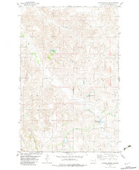
1982 Map of Cluster Buttes NW
USGS Topo · Published 1983About this map
Box Elder Creek meanders through this portion of eastern Montana, defining the local drainage patterns across a landscape marked by intermittent water sources and high plains relief. During this period in the early 1980s, the land was managed through an extensive network of ranching infrastructure, evidenced by the numerous Well and Spring labels that signify critical water points for livestock. The presence of Milliron Reservoir No 1 and Milliron Reservoir No 2 suggests a structured approach to water management and storage in an environment where surface water is seasonal. Fine red dashed lines throughout the quadrangle indicate the placement of selected fence lines, providing a detailed look at property boundaries and land division in the late twentieth century. This survey documents the intersection of natural topography and the human modifications necessary to sustain agricultural life in the region.
Find a feature on this map
7 named features on this map. Tap any name to fly to it.
Don’t see what you’re looking for? This feature index may not catch every label — zoom into the map to look around manually.
Map Details
Editions of this 1982 Cluster Buttes NW Map
This is the sole edition of this map. No revisions or reprints were ever made.
Other maps of this area

1909 · Glendive
USGS Topo · 1:250,000

1954 · Glendive
USGS Topo · 1:250,000

1957 · Glendive
USGS Topo · 1:250,000

1958 · Glendive
USGS Topo · 1:250,000

1966 · Savage SE
USGS Topo · 1:24,000

1966 · Savage SW
USGS Topo · 1:24,000

1966 · Intake
USGS Topo · 1:24,000

1967 · Allard
USGS Topo · 1:24,000

1967 · Belle Prairie
USGS Topo · 1:24,000

1981 · Glendive
USGS Topo · 1:100,000