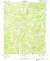
1968 Map of Cluster Springs
USGS Topo · Published 1972About this map
Hyco River and the John H. Kerr Reservoir dominate the rural landscape of this borderland area during the late 1960s. The map illustrates the interstate boundary between Halifax County, Virginia and Person County, North Carolina, a region defined by scattered agricultural settlements and a dense network of country churches. Small communities like Denniston, Harmony, and Cluster Springs serve as local anchors, while the Norfolk and Western and Norfolk and Danville railroads provide the primary industrial corridors through the rolling terrain.
Find a feature on this map
45 named features on this map. Tap any name to fly to it.
Don’t see what you’re looking for? This feature index may not catch every label — zoom into the map to look around manually.
Map Details
Editions of this 1968 Cluster Springs Map
3 editions found
Other maps of this area

1943 · Roxboro
USGS Topo · 1:62,500

1952 · Milton
USGS Topo · 1:62,500

1953 · South Boston
USGS Topo · 1:62,500

1953 · Greensboro
USGS Topo · 1:250,000

1954 · Greensboro
USGS Topo · 1:250,000

1956 · Milton
USGS Topo · 1:62,500

1957 · South Boston
USGS Topo · 1:62,500

1962 · Greensboro
USGS Topo · 1:250,000

1966 · Greensboro
USGS Topo · 1:250,000
1968 · Alton
USGS Topo · 1:24,000